You are here: Home > Network List > CI - Caltech Regional Seismic Network Stations List
> Station DGR Domenigoni Reservoir, California, USA > Earthquake Result Viewer
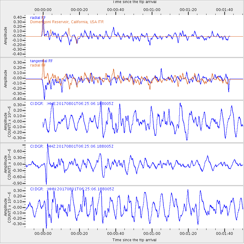
DGR Domenigoni Reservoir, California, USA - Earthquake Result Viewer
*The percent match for this event was below the threshold and hence no stack was calculated.
| Earthquake location: |
La Rioja Province, Argentina |
| Earthquake latitude/longitude: |
-28.6/-68.7 |
| Earthquake time(UTC): |
2017/08/01 (213) 06:13:53 GMT |
| Earthquake Depth: |
85 km |
| Earthquake Magnitude: |
5.6 Mww |
| Earthquake Catalog/Contributor: |
NEIC PDE/us |
|
| Network: |
CI Caltech Regional Seismic Network |
| Station: |
DGR Domenigoni Reservoir, California, USA |
| Lat/Lon: |
33.65 N/117.01 W |
| Elevation: |
609 m |
|
| Distance: |
76.9 deg |
| Az: |
320.256 deg |
| Baz: |
137.602 deg |
| Ray Param: |
$rayparam |
*The percent match for this event was below the threshold and hence was not used in the summary stack. |
|
| Radial Match: |
60.531937 % |
| Radial Bump: |
400 |
| Transverse Match: |
53.66218 % |
| Transverse Bump: |
400 |
| SOD ConfigId: |
13570011 |
| Insert Time: |
2019-04-28 12:34:15.106 +0000 |
| GWidth: |
2.5 |
| Max Bumps: |
400 |
| Tol: |
0.001 |
|
Signal To Noise
| Channel | StoN | STA | LTA |
| CI:DGR: :HHZ:20170801T06:25:06.188005Z | 5.437404 | 3.8627255E-7 | 7.1039885E-8 |
| CI:DGR: :HHN:20170801T06:25:06.188005Z | 2.0632653 | 1.5989755E-7 | 7.749733E-8 |
| CI:DGR: :HHE:20170801T06:25:06.188005Z | 1.4767097 | 1.7270638E-7 | 1.1695351E-7 |
| Arrivals |
| Ps | |
| PpPs | |
| PsPs/PpSs | |


