You are here: Home > Network List > CI - Caltech Regional Seismic Network Stations List
> Station MPP McPhearson Peak > Earthquake Result Viewer
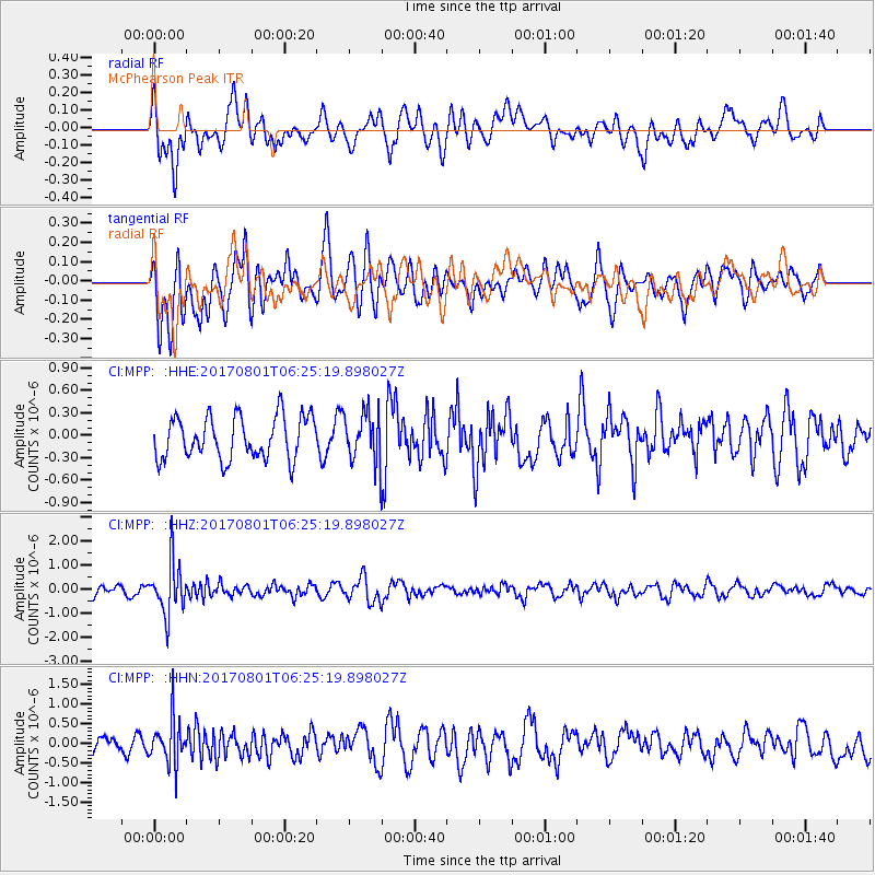
MPP McPhearson Peak - Earthquake Result Viewer
*The percent match for this event was below the threshold and hence no stack was calculated.
| Earthquake location: |
La Rioja Province, Argentina |
| Earthquake latitude/longitude: |
-28.6/-68.7 |
| Earthquake time(UTC): |
2017/08/01 (213) 06:13:53 GMT |
| Earthquake Depth: |
85 km |
| Earthquake Magnitude: |
5.6 Mww |
| Earthquake Catalog/Contributor: |
NEIC PDE/us |
|
| Network: |
CI Caltech Regional Seismic Network |
| Station: |
MPP McPhearson Peak |
| Lat/Lon: |
34.89 N/119.81 W |
| Elevation: |
1739 m |
|
| Distance: |
79.4 deg |
| Az: |
319.393 deg |
| Baz: |
135.854 deg |
| Ray Param: |
$rayparam |
*The percent match for this event was below the threshold and hence was not used in the summary stack. |
|
| Radial Match: |
55.137547 % |
| Radial Bump: |
400 |
| Transverse Match: |
74.51301 % |
| Transverse Bump: |
400 |
| SOD ConfigId: |
13570011 |
| Insert Time: |
2019-04-28 12:34:27.730 +0000 |
| GWidth: |
2.5 |
| Max Bumps: |
400 |
| Tol: |
0.001 |
|
Signal To Noise
| Channel | StoN | STA | LTA |
| CI:MPP: :HHZ:20170801T06:25:19.898027Z | 3.9428675 | 1.0665285E-6 | 2.7049566E-7 |
| CI:MPP: :HHN:20170801T06:25:19.898027Z | 2.6166775 | 5.882987E-7 | 2.2482658E-7 |
| CI:MPP: :HHE:20170801T06:25:19.898027Z | 1.1648937 | 3.2913195E-7 | 2.8254246E-7 |
| Arrivals |
| Ps | |
| PpPs | |
| PsPs/PpSs | |


