You are here: Home > Network List > TA - USArray Transportable Network (new EarthScope stations) Stations List
> Station I28A Midland, SD, USA > Earthquake Result Viewer
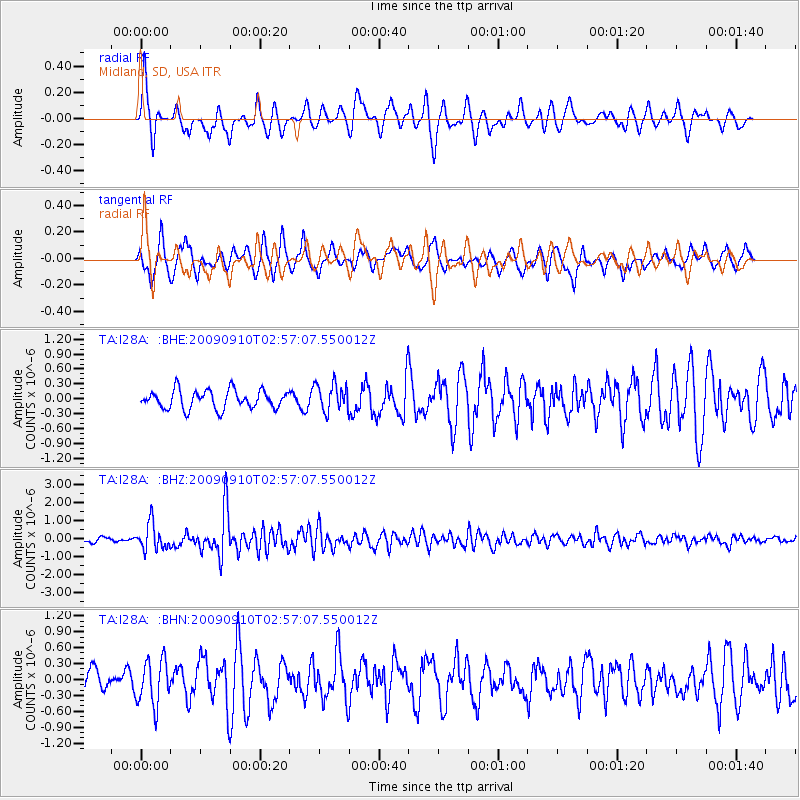
I28A Midland, SD, USA - Earthquake Result Viewer
*The percent match for this event was below the threshold and hence no stack was calculated.
| Earthquake location: |
Kuril Islands |
| Earthquake latitude/longitude: |
48.3/154.2 |
| Earthquake time(UTC): |
2009/09/10 (253) 02:46:50 GMT |
| Earthquake Depth: |
36 km |
| Earthquake Magnitude: |
6.0 MB, 5.5 MS, 6.0 MW, 5.8 MW |
| Earthquake Catalog/Contributor: |
WHDF/NEIC |
|
| Network: |
TA USArray Transportable Network (new EarthScope stations) |
| Station: |
I28A Midland, SD, USA |
| Lat/Lon: |
44.00 N/101.17 W |
| Elevation: |
655 m |
|
| Distance: |
66.8 deg |
| Az: |
49.428 deg |
| Baz: |
315.366 deg |
| Ray Param: |
$rayparam |
*The percent match for this event was below the threshold and hence was not used in the summary stack. |
|
| Radial Match: |
72.44661 % |
| Radial Bump: |
358 |
| Transverse Match: |
79.082016 % |
| Transverse Bump: |
400 |
| SOD ConfigId: |
2622 |
| Insert Time: |
2010-03-06 02:32:11.020 +0000 |
| GWidth: |
2.5 |
| Max Bumps: |
400 |
| Tol: |
0.001 |
|
Signal To Noise
| Channel | StoN | STA | LTA |
| TA:I28A: :BHZ:20090910T02:57:07.550012Z | 5.000625 | 7.278215E-7 | 1.4554611E-7 |
| TA:I28A: :BHN:20090910T02:57:07.550012Z | 1.960823 | 4.2197644E-7 | 2.1520374E-7 |
| TA:I28A: :BHE:20090910T02:57:07.550012Z | 1.5166599 | 2.7953888E-7 | 1.8431217E-7 |
| Arrivals |
| Ps | |
| PpPs | |
| PsPs/PpSs | |


