
I20A Worland, WY, USA - Earthquake Result Viewer
| ||||||||||||||||||
| ||||||||||||||||||
| ||||||||||||||||||
|
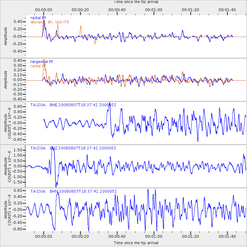
Signal To Noise
| Channel | StoN | STA | LTA |
| TA:I20A: :BHZ:20080807T18:37:42.200005Z | 10.065486 | 6.2366547E-7 | 6.196079E-8 |
| TA:I20A: :BHN:20080807T18:37:42.200005Z | 1.7033055 | 1.3681115E-7 | 8.032097E-8 |
| TA:I20A: :BHE:20080807T18:37:42.200005Z | 1.5284706 | 1.4183274E-7 | 9.279389E-8 |
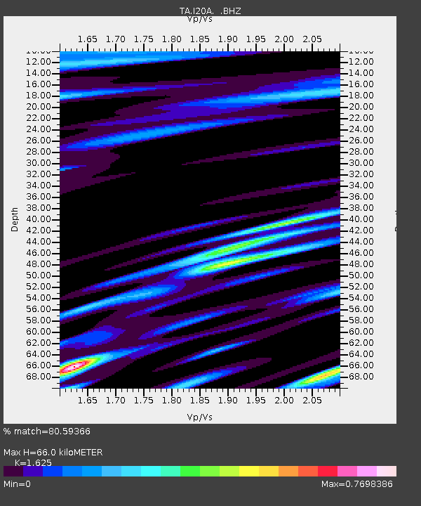
| Arrivals | |
| Ps | 7.1 SECOND |
| PpPs | 26 SECOND |
| PsPs/PpSs | 33 SECOND |

