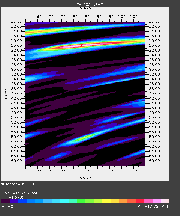
I20A Worland, WY, USA - Earthquake Result Viewer
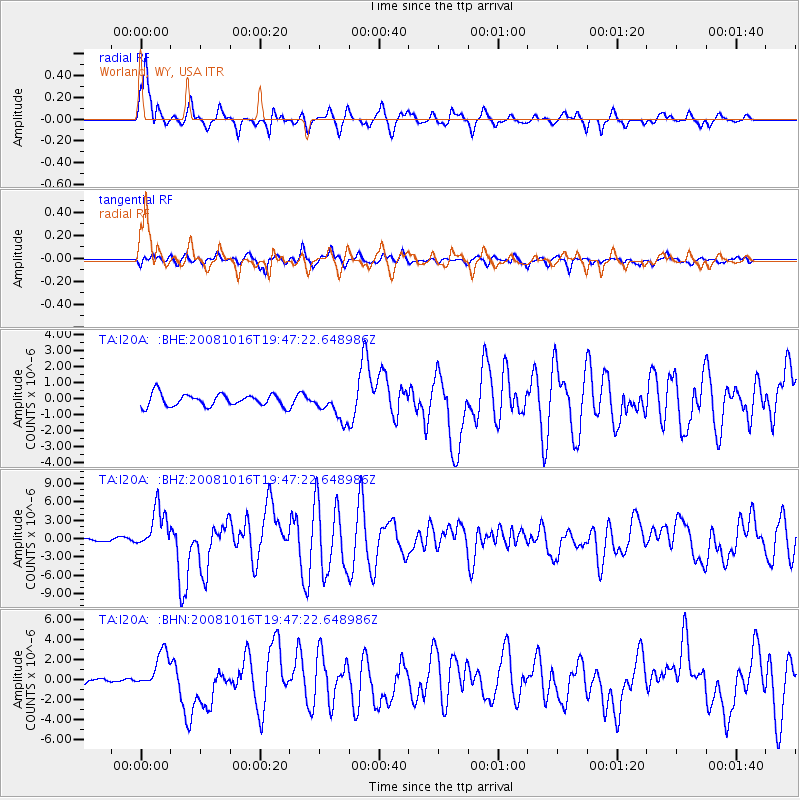
Earthquake location: Near Coast Of Chiapas, Mexico
Earthquake latitude/longitude: 14.4/-92.4
Earthquake time(UTC): 2008/10/16 (290) 19:41:25 GMT
Earthquake Depth: 24 km
Earthquake Magnitude: 6.1 MB, 6.6 MS, 6.7 MW, 6.6 MW
Earthquake Catalog/Contributor: WHDF/NEIC
Network: TA USArray Transportable Network (new EarthScope stations)
Station: I20A Worland, WY, USA
Lat/Lon: 43.95 N/108.13 W
Elevation: 1342 m
Distance: 32.4 deg
Az: 338.495 deg
Baz: 150.545 deg
Ray Param: 0.07865421
Estimated Moho Depth: 19.75 km
Estimated Crust Vp/Vs: 1.83
Assumed Crust Vp: 6.161 km/s
Estimated Crust Vs: 3.362 km/s
Estimated Crust Poisson's Ratio: 0.29
Radial Match: 89.71825 %
Radial Bump: 400
Transverse Match: 76.41298 %
Transverse Bump: 400
SOD ConfigId: 2556
Insert Time: 2010-03-06 02:32:24.803 +0000
GWidth: 2.5
Max Bumps: 400
Tol: 0.001

Signal To Noise

ChannelStoNSTALTA
TA:I20A: :BHZ:20081016T19:47:22.648986Z8.6441193.420575E-63.9571123E-7
TA:I20A: :BHN:20081016T19:47:22.648986Z7.3485241.8543926E-62.52349E-7
TA:I20A: :BHE:20081016T19:47:22.648986Z2.36367429.0505733E-73.8290275E-7
Arrivals
Ps2.9 SECOND
PpPs8.5 SECOND
PsPs/PpSs11 SECOND