I20A Worland, WY, USA - Earthquake Result Viewer
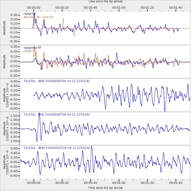
Earthquake location: Near East Coast Of Honshu, Japan
Earthquake latitude/longitude: 35.5/140.9
Earthquake time(UTC): 2009/06/06 (157) 05:52:43 GMT
Earthquake Depth: 34 km
Earthquake Magnitude: 5.8 MB, 5.4 MS, 5.8 MW, 5.7 MW
Earthquake Catalog/Contributor: WHDF/NEIC
Network: TA USArray Transportable Network (new EarthScope stations)
Station: I20A Worland, WY, USA
Lat/Lon: 43.95 N/108.13 W
Elevation: 1342 m
Distance: 79.1 deg
Az: 43.381 deg
Baz: 309.096 deg
Ray Param: 0.04913384
Estimated Moho Depth: 17.0 km
Estimated Crust Vp/Vs: 1.76
Assumed Crust Vp: 6.161 km/s
Estimated Crust Vs: 3.491 km/s
Estimated Crust Poisson's Ratio: 0.26
Radial Match: 85.22668 %
Radial Bump: 400
Transverse Match: 69.35094 %
Transverse Bump: 400
SOD ConfigId: 2648
Insert Time: 2010-03-06 02:32:48.902 +0000
GWidth: 2.5
Max Bumps: 400
Tol: 0.001

Signal To Noise

ChannelStoNSTALTA
TA:I20A: :BHZ:20090606T06:04:13.325024Z18.2801468.871071E-74.852845E-8
TA:I20A: :BHN:20090606T06:04:13.325024Z2.91973022.7075956E-79.2734446E-8
TA:I20A: :BHE:20090606T06:04:13.325024Z1.99755781.4428359E-77.222999E-8
Arrivals
Ps2.2 SECOND
PpPs7.4 SECOND
PsPs/PpSs9.6 SECOND