You are here: Home > Network List > UW - Pacific Northwest Regional Seismic Network Stations List
> Station LEBA Lebam, WA, USA > Earthquake Result Viewer
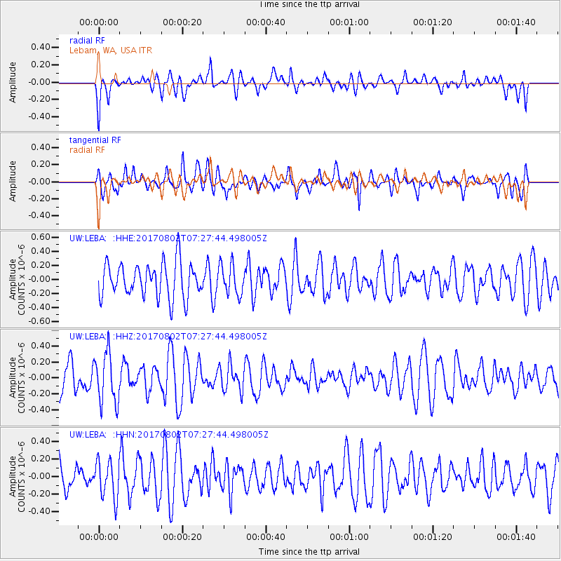
LEBA Lebam, WA, USA - Earthquake Result Viewer
*The percent match for this event was below the threshold and hence no stack was calculated.
| Earthquake location: |
Chile-Argentina Border Region |
| Earthquake latitude/longitude: |
-33.2/-70.6 |
| Earthquake time(UTC): |
2017/08/02 (214) 07:15:13 GMT |
| Earthquake Depth: |
88 km |
| Earthquake Magnitude: |
5.5 Mww |
| Earthquake Catalog/Contributor: |
NEIC PDE/us |
|
| Network: |
UW Pacific Northwest Regional Seismic Network |
| Station: |
LEBA Lebam, WA, USA |
| Lat/Lon: |
46.55 N/123.56 W |
| Elevation: |
73 m |
|
| Distance: |
92.6 deg |
| Az: |
326.546 deg |
| Baz: |
137.963 deg |
| Ray Param: |
$rayparam |
*The percent match for this event was below the threshold and hence was not used in the summary stack. |
|
| Radial Match: |
42.429573 % |
| Radial Bump: |
400 |
| Transverse Match: |
58.916206 % |
| Transverse Bump: |
400 |
| SOD ConfigId: |
13570011 |
| Insert Time: |
2019-04-28 12:50:50.930 +0000 |
| GWidth: |
2.5 |
| Max Bumps: |
400 |
| Tol: |
0.001 |
|
Signal To Noise
| Channel | StoN | STA | LTA |
| UW:LEBA: :HHZ:20170802T07:27:44.498005Z | 2.4441626 | 3.2035015E-7 | 1.3106745E-7 |
| UW:LEBA: :HHN:20170802T07:27:44.498005Z | 1.2241257 | 2.1752065E-7 | 1.7769469E-7 |
| UW:LEBA: :HHE:20170802T07:27:44.498005Z | 0.88191044 | 2.1507735E-7 | 2.4387663E-7 |
| Arrivals |
| Ps | |
| PpPs | |
| PsPs/PpSs | |


