You are here: Home > Network List > TA - USArray Transportable Network (new EarthScope stations) Stations List
> Station I20A Worland, WY, USA > Earthquake Result Viewer
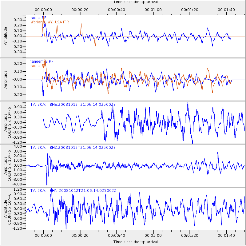
I20A Worland, WY, USA - Earthquake Result Viewer
*The percent match for this event was below the threshold and hence no stack was calculated.
| Earthquake location: |
Southern Bolivia |
| Earthquake latitude/longitude: |
-20.1/-65.0 |
| Earthquake time(UTC): |
2008/10/12 (286) 20:55:41 GMT |
| Earthquake Depth: |
353 km |
| Earthquake Magnitude: |
6.0 MB, 6.2 MW, 6.2 MW |
| Earthquake Catalog/Contributor: |
WHDF/NEIC |
|
| Network: |
TA USArray Transportable Network (new EarthScope stations) |
| Station: |
I20A Worland, WY, USA |
| Lat/Lon: |
43.95 N/108.13 W |
| Elevation: |
1342 m |
|
| Distance: |
75.0 deg |
| Az: |
329.241 deg |
| Baz: |
138.288 deg |
| Ray Param: |
$rayparam |
*The percent match for this event was below the threshold and hence was not used in the summary stack. |
|
| Radial Match: |
48.229725 % |
| Radial Bump: |
400 |
| Transverse Match: |
50.885662 % |
| Transverse Bump: |
400 |
| SOD ConfigId: |
2556 |
| Insert Time: |
2010-03-06 02:33:21.469 +0000 |
| GWidth: |
2.5 |
| Max Bumps: |
400 |
| Tol: |
0.001 |
|
Signal To Noise
| Channel | StoN | STA | LTA |
| TA:I20A: :BHZ:20081012T21:06:14.025002Z | 8.272963 | 1.3747373E-6 | 1.661723E-7 |
| TA:I20A: :BHN:20081012T21:06:14.025002Z | 2.5236437 | 5.1020834E-7 | 2.0217128E-7 |
| TA:I20A: :BHE:20081012T21:06:14.025002Z | 1.7543517 | 4.9039045E-7 | 2.7952802E-7 |
| Arrivals |
| Ps | |
| PpPs | |
| PsPs/PpSs | |


