You are here: Home > Network List > TA - USArray Transportable Network (new EarthScope stations) Stations List
> Station I20A Worland, WY, USA > Earthquake Result Viewer
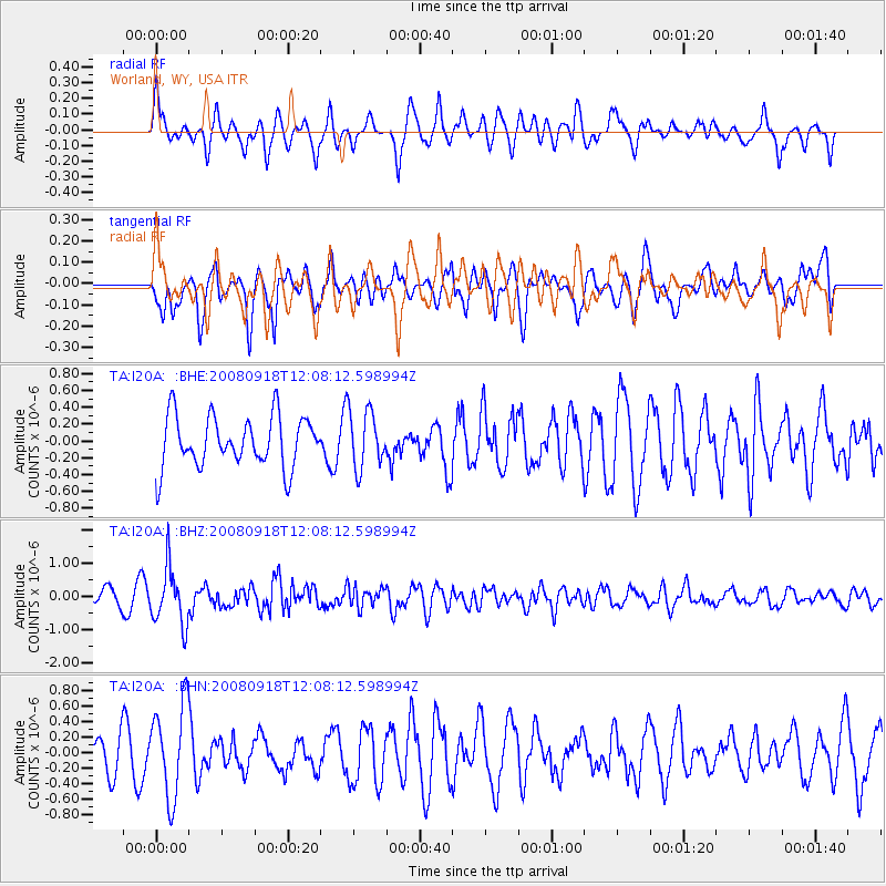
I20A Worland, WY, USA - Earthquake Result Viewer
*The percent match for this event was below the threshold and hence no stack was calculated.
| Earthquake location: |
Near East Coast Of Kamchatka |
| Earthquake latitude/longitude: |
51.9/158.4 |
| Earthquake time(UTC): |
2008/09/18 (262) 11:58:50 GMT |
| Earthquake Depth: |
67 km |
| Earthquake Magnitude: |
5.7 MB, 5.9 MW, 5.8 MW |
| Earthquake Catalog/Contributor: |
WHDF/NEIC |
|
| Network: |
TA USArray Transportable Network (new EarthScope stations) |
| Station: |
I20A Worland, WY, USA |
| Lat/Lon: |
43.95 N/108.13 W |
| Elevation: |
1342 m |
|
| Distance: |
58.9 deg |
| Az: |
57.302 deg |
| Baz: |
313.815 deg |
| Ray Param: |
$rayparam |
*The percent match for this event was below the threshold and hence was not used in the summary stack. |
|
| Radial Match: |
67.875084 % |
| Radial Bump: |
400 |
| Transverse Match: |
56.903736 % |
| Transverse Bump: |
400 |
| SOD ConfigId: |
2560 |
| Insert Time: |
2010-03-06 02:33:25.161 +0000 |
| GWidth: |
2.5 |
| Max Bumps: |
400 |
| Tol: |
0.001 |
|
Signal To Noise
| Channel | StoN | STA | LTA |
| TA:I20A: :BHZ:20080918T12:08:12.598994Z | 3.7896187 | 8.486371E-7 | 2.2393733E-7 |
| TA:I20A: :BHN:20080918T12:08:12.598994Z | 2.5594604 | 5.9220656E-7 | 2.3137946E-7 |
| TA:I20A: :BHE:20080918T12:08:12.598994Z | 1.1245954 | 3.4066161E-7 | 3.0291926E-7 |
| Arrivals |
| Ps | |
| PpPs | |
| PsPs/PpSs | |


