You are here: Home > Network List > TA - USArray Transportable Network (new EarthScope stations) Stations List
> Station I20A Worland, WY, USA > Earthquake Result Viewer
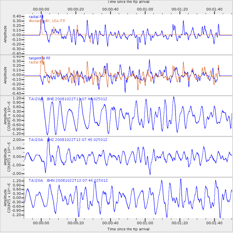
I20A Worland, WY, USA - Earthquake Result Viewer
*The percent match for this event was below the threshold and hence no stack was calculated.
| Earthquake location: |
Tonga Islands |
| Earthquake latitude/longitude: |
-18.4/-175.4 |
| Earthquake time(UTC): |
2008/10/22 (296) 12:55:57 GMT |
| Earthquake Depth: |
233 km |
| Earthquake Magnitude: |
5.9 MB, 6.4 MW, 6.3 MW |
| Earthquake Catalog/Contributor: |
WHDF/NEIC |
|
| Network: |
TA USArray Transportable Network (new EarthScope stations) |
| Station: |
I20A Worland, WY, USA |
| Lat/Lon: |
43.95 N/108.13 W |
| Elevation: |
1342 m |
|
| Distance: |
87.2 deg |
| Az: |
41.815 deg |
| Baz: |
241.213 deg |
| Ray Param: |
$rayparam |
*The percent match for this event was below the threshold and hence was not used in the summary stack. |
|
| Radial Match: |
57.628464 % |
| Radial Bump: |
400 |
| Transverse Match: |
50.510765 % |
| Transverse Bump: |
400 |
| SOD ConfigId: |
2560 |
| Insert Time: |
2010-03-06 02:33:28.622 +0000 |
| GWidth: |
2.5 |
| Max Bumps: |
400 |
| Tol: |
0.001 |
|
Signal To Noise
| Channel | StoN | STA | LTA |
| TA:I20A: :BHZ:20081022T13:07:46.02501Z | 2.8146167 | 1.1204414E-6 | 3.9807955E-7 |
| TA:I20A: :BHN:20081022T13:07:46.02501Z | 0.7596007 | 4.4477403E-7 | 5.855366E-7 |
| TA:I20A: :BHE:20081022T13:07:46.02501Z | 0.84824777 | 6.131258E-7 | 7.228145E-7 |
| Arrivals |
| Ps | |
| PpPs | |
| PsPs/PpSs | |


