You are here: Home > Network List > TA - USArray Transportable Network (new EarthScope stations) Stations List
> Station I20A Worland, WY, USA > Earthquake Result Viewer
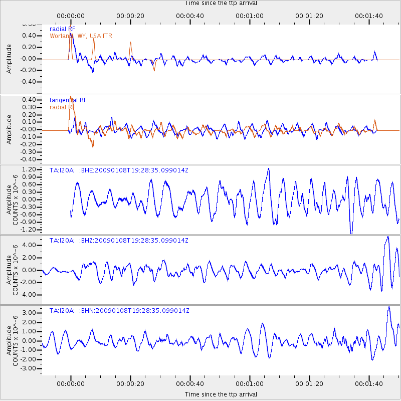
I20A Worland, WY, USA - Earthquake Result Viewer
*The percent match for this event was below the threshold and hence no stack was calculated.
| Earthquake location: |
Costa Rica |
| Earthquake latitude/longitude: |
10.2/-84.2 |
| Earthquake time(UTC): |
2009/01/08 (008) 19:21:35 GMT |
| Earthquake Depth: |
14 km |
| Earthquake Magnitude: |
5.7 MB, 6.0 MS, 6.1 MW, 6.1 MW |
| Earthquake Catalog/Contributor: |
WHDF/NEIC |
|
| Network: |
TA USArray Transportable Network (new EarthScope stations) |
| Station: |
I20A Worland, WY, USA |
| Lat/Lon: |
43.95 N/108.13 W |
| Elevation: |
1342 m |
|
| Distance: |
39.5 deg |
| Az: |
332.596 deg |
| Baz: |
141.144 deg |
| Ray Param: |
$rayparam |
*The percent match for this event was below the threshold and hence was not used in the summary stack. |
|
| Radial Match: |
76.0777 % |
| Radial Bump: |
400 |
| Transverse Match: |
53.522373 % |
| Transverse Bump: |
400 |
| SOD ConfigId: |
2834 |
| Insert Time: |
2010-03-06 02:33:30.797 +0000 |
| GWidth: |
2.5 |
| Max Bumps: |
400 |
| Tol: |
0.001 |
|
Signal To Noise
| Channel | StoN | STA | LTA |
| TA:I20A: :BHZ:20090108T19:28:35.099014Z | 2.8346615 | 7.6236967E-7 | 2.689456E-7 |
| TA:I20A: :BHN:20090108T19:28:35.099014Z | 0.8231319 | 4.5218823E-7 | 5.493509E-7 |
| TA:I20A: :BHE:20090108T19:28:35.099014Z | 1.8206806 | 5.1893034E-7 | 2.8501995E-7 |
| Arrivals |
| Ps | |
| PpPs | |
| PsPs/PpSs | |


