You are here: Home > Network List > AV - Alaska Volcano Observatory Stations List
> Station MAPS Pakushin Southeast, Makushin Volcano, Alaska > Earthquake Result Viewer
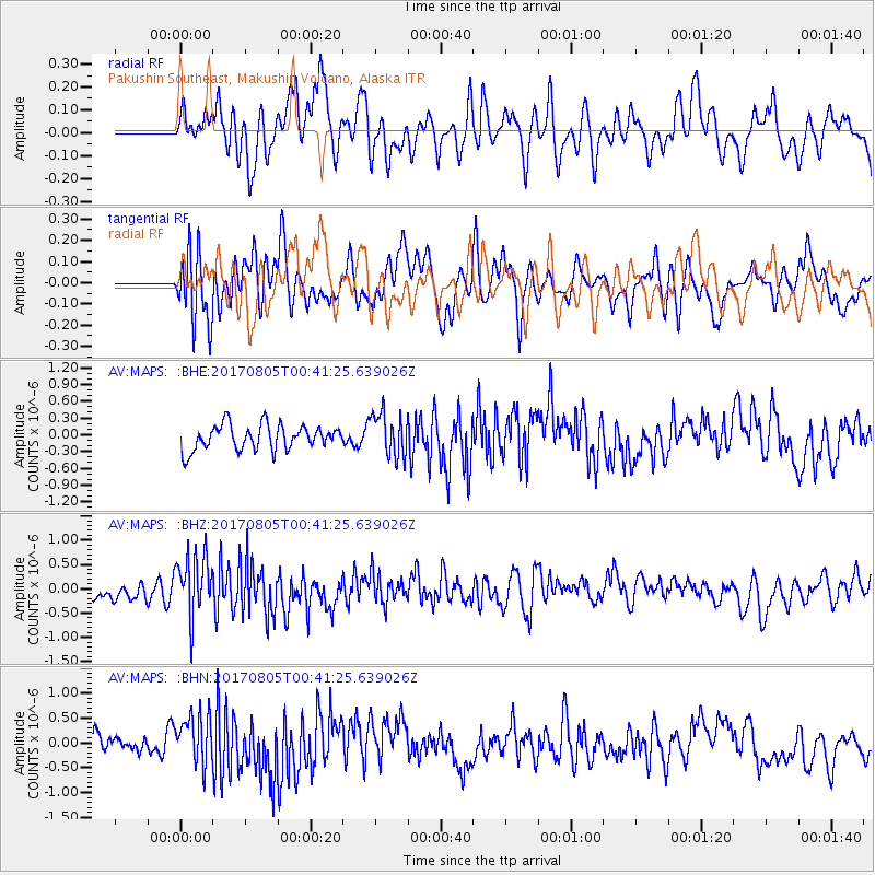
MAPS Pakushin Southeast, Makushin Volcano, Alaska - Earthquake Result Viewer
*The percent match for this event was below the threshold and hence no stack was calculated.
| Earthquake location: |
Mindanao, Philippines |
| Earthquake latitude/longitude: |
6.2/125.5 |
| Earthquake time(UTC): |
2017/08/05 (217) 00:30:41 GMT |
| Earthquake Depth: |
74 km |
| Earthquake Magnitude: |
5.8 Mww |
| Earthquake Catalog/Contributor: |
NEIC PDE/us |
|
| Network: |
AV Alaska Volcano Observatory |
| Station: |
MAPS Pakushin Southeast, Makushin Volcano, Alaska |
| Lat/Lon: |
53.81 N/166.94 W |
| Elevation: |
333 m |
|
| Distance: |
71.9 deg |
| Az: |
35.232 deg |
| Baz: |
255.267 deg |
| Ray Param: |
$rayparam |
*The percent match for this event was below the threshold and hence was not used in the summary stack. |
|
| Radial Match: |
53.637993 % |
| Radial Bump: |
400 |
| Transverse Match: |
52.390526 % |
| Transverse Bump: |
400 |
| SOD ConfigId: |
13570011 |
| Insert Time: |
2019-04-28 12:53:25.225 +0000 |
| GWidth: |
2.5 |
| Max Bumps: |
400 |
| Tol: |
0.001 |
|
Signal To Noise
| Channel | StoN | STA | LTA |
| AV:MAPS: :BHZ:20170805T00:41:25.639026Z | 3.6321058 | 6.283886E-7 | 1.7300944E-7 |
| AV:MAPS: :BHN:20170805T00:41:25.639026Z | 2.688326 | 5.032357E-7 | 1.8719298E-7 |
| AV:MAPS: :BHE:20170805T00:41:25.639026Z | 1.7583756 | 3.928443E-7 | 2.234132E-7 |
| Arrivals |
| Ps | |
| PpPs | |
| PsPs/PpSs | |


