You are here: Home > Network List > TA - USArray Transportable Network (new EarthScope stations) Stations List
> Station I20A Worland, WY, USA > Earthquake Result Viewer
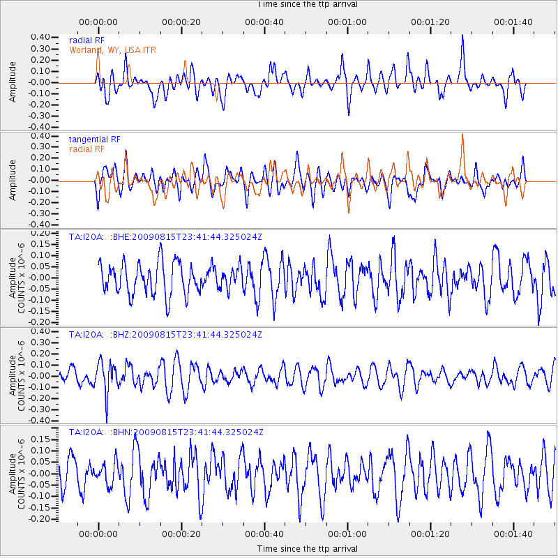
I20A Worland, WY, USA - Earthquake Result Viewer
*The percent match for this event was below the threshold and hence no stack was calculated.
| Earthquake location: |
Fiji Islands Region |
| Earthquake latitude/longitude: |
-19.8/-178.2 |
| Earthquake time(UTC): |
2009/08/15 (227) 23:30:19 GMT |
| Earthquake Depth: |
608 km |
| Earthquake Magnitude: |
5.6 MW, 5.2 MB |
| Earthquake Catalog/Contributor: |
WHDF/NEIC |
|
| Network: |
TA USArray Transportable Network (new EarthScope stations) |
| Station: |
I20A Worland, WY, USA |
| Lat/Lon: |
43.95 N/108.13 W |
| Elevation: |
1342 m |
|
| Distance: |
90.1 deg |
| Az: |
42.781 deg |
| Baz: |
242.288 deg |
| Ray Param: |
$rayparam |
*The percent match for this event was below the threshold and hence was not used in the summary stack. |
|
| Radial Match: |
68.020615 % |
| Radial Bump: |
400 |
| Transverse Match: |
53.645863 % |
| Transverse Bump: |
400 |
| SOD ConfigId: |
2622 |
| Insert Time: |
2010-03-06 02:33:40.574 +0000 |
| GWidth: |
2.5 |
| Max Bumps: |
400 |
| Tol: |
0.001 |
|
Signal To Noise
| Channel | StoN | STA | LTA |
| TA:I20A: :BHZ:20090815T23:41:44.325024Z | 2.5308802 | 1.4178298E-7 | 5.602121E-8 |
| TA:I20A: :BHN:20090815T23:41:44.325024Z | 0.76392794 | 4.8514014E-8 | 6.3506015E-8 |
| TA:I20A: :BHE:20090815T23:41:44.325024Z | 0.6369118 | 4.55648E-8 | 7.15402E-8 |
| Arrivals |
| Ps | |
| PpPs | |
| PsPs/PpSs | |


