You are here: Home > Network List > TA - USArray Transportable Network (new EarthScope stations) Stations List
> Station I20A Worland, WY, USA > Earthquake Result Viewer
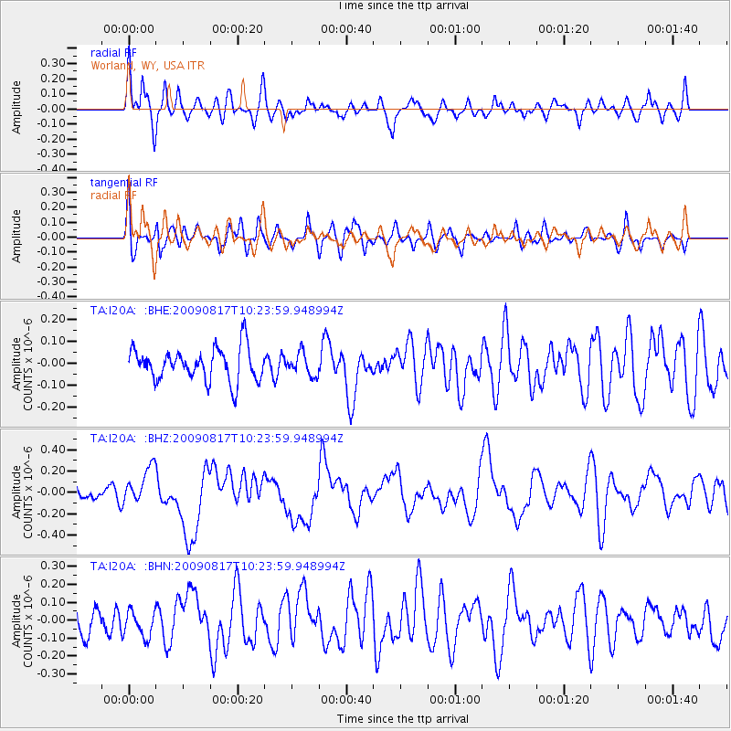
I20A Worland, WY, USA - Earthquake Result Viewer
*The percent match for this event was below the threshold and hence no stack was calculated.
| Earthquake location: |
Southwestern Ryukyu Isl., Japan |
| Earthquake latitude/longitude: |
23.4/123.5 |
| Earthquake time(UTC): |
2009/08/17 (229) 10:10:55 GMT |
| Earthquake Depth: |
10 km |
| Earthquake Magnitude: |
5.9 MB, 6.2 MS, 6.1 MW, 6.1 MW |
| Earthquake Catalog/Contributor: |
WHDF/NEIC |
|
| Network: |
TA USArray Transportable Network (new EarthScope stations) |
| Station: |
I20A Worland, WY, USA |
| Lat/Lon: |
43.95 N/108.13 W |
| Elevation: |
1342 m |
|
| Distance: |
97.9 deg |
| Az: |
34.888 deg |
| Baz: |
313.33 deg |
| Ray Param: |
$rayparam |
*The percent match for this event was below the threshold and hence was not used in the summary stack. |
|
| Radial Match: |
51.37257 % |
| Radial Bump: |
400 |
| Transverse Match: |
64.1251 % |
| Transverse Bump: |
400 |
| SOD ConfigId: |
2622 |
| Insert Time: |
2010-03-06 02:33:42.450 +0000 |
| GWidth: |
2.5 |
| Max Bumps: |
400 |
| Tol: |
0.001 |
|
Signal To Noise
| Channel | StoN | STA | LTA |
| TA:I20A: :BHZ:20090817T10:23:59.948994Z | 2.6175568 | 1.7173687E-7 | 6.5609605E-8 |
| TA:I20A: :BHN:20090817T10:23:59.948994Z | 0.74467987 | 7.304468E-8 | 9.8088705E-8 |
| TA:I20A: :BHE:20090817T10:23:59.948994Z | 0.693813 | 5.134034E-8 | 7.399737E-8 |
| Arrivals |
| Ps | |
| PpPs | |
| PsPs/PpSs | |


