You are here: Home > Network List > TA - USArray Transportable Network (new EarthScope stations) Stations List
> Station I20A Worland, WY, USA > Earthquake Result Viewer
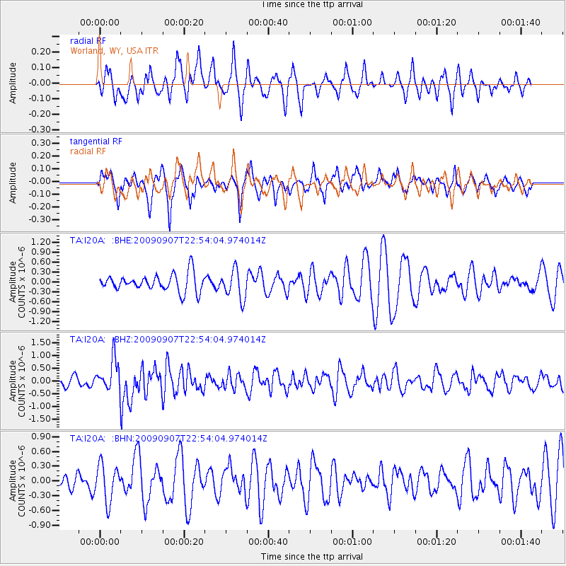
I20A Worland, WY, USA - Earthquake Result Viewer
*The percent match for this event was below the threshold and hence no stack was calculated.
| Earthquake location: |
Northwestern Caucasus |
| Earthquake latitude/longitude: |
42.7/43.4 |
| Earthquake time(UTC): |
2009/09/07 (250) 22:41:37 GMT |
| Earthquake Depth: |
15 km |
| Earthquake Magnitude: |
5.7 MB, 5.8 MS, 6.0 MW, 5.9 MW |
| Earthquake Catalog/Contributor: |
WHDF/NEIC |
|
| Network: |
TA USArray Transportable Network (new EarthScope stations) |
| Station: |
I20A Worland, WY, USA |
| Lat/Lon: |
43.95 N/108.13 W |
| Elevation: |
1342 m |
|
| Distance: |
90.1 deg |
| Az: |
339.888 deg |
| Baz: |
20.559 deg |
| Ray Param: |
$rayparam |
*The percent match for this event was below the threshold and hence was not used in the summary stack. |
|
| Radial Match: |
58.417294 % |
| Radial Bump: |
376 |
| Transverse Match: |
53.77188 % |
| Transverse Bump: |
316 |
| SOD ConfigId: |
2622 |
| Insert Time: |
2010-03-06 02:33:47.269 +0000 |
| GWidth: |
2.5 |
| Max Bumps: |
400 |
| Tol: |
0.001 |
|
Signal To Noise
| Channel | StoN | STA | LTA |
| TA:I20A: :BHZ:20090907T22:54:04.974014Z | 2.5920236 | 6.297784E-7 | 2.4296787E-7 |
| TA:I20A: :BHN:20090907T22:54:04.974014Z | 1.4301703 | 3.856212E-7 | 2.696331E-7 |
| TA:I20A: :BHE:20090907T22:54:04.974014Z | 1.7204208 | 4.5097642E-7 | 2.6213146E-7 |
| Arrivals |
| Ps | |
| PpPs | |
| PsPs/PpSs | |


