You are here: Home > Network List > TA - USArray Transportable Network (new EarthScope stations) Stations List
> Station I20A Worland, WY, USA > Earthquake Result Viewer
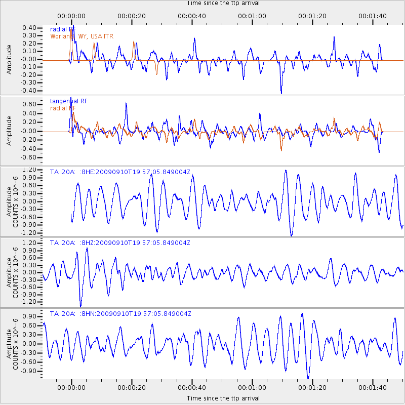
I20A Worland, WY, USA - Earthquake Result Viewer
*The percent match for this event was below the threshold and hence no stack was calculated.
| Earthquake location: |
Easter Island Region |
| Earthquake latitude/longitude: |
-29.9/-111.8 |
| Earthquake time(UTC): |
2009/09/10 (253) 19:46:03 GMT |
| Earthquake Depth: |
10 km |
| Earthquake Magnitude: |
5.5 MW, 5.4 MB |
| Earthquake Catalog/Contributor: |
WHDF/NEIC |
|
| Network: |
TA USArray Transportable Network (new EarthScope stations) |
| Station: |
I20A Worland, WY, USA |
| Lat/Lon: |
43.95 N/108.13 W |
| Elevation: |
1342 m |
|
| Distance: |
73.6 deg |
| Az: |
2.782 deg |
| Baz: |
183.344 deg |
| Ray Param: |
$rayparam |
*The percent match for this event was below the threshold and hence was not used in the summary stack. |
|
| Radial Match: |
52.685425 % |
| Radial Bump: |
400 |
| Transverse Match: |
57.524055 % |
| Transverse Bump: |
400 |
| SOD ConfigId: |
2622 |
| Insert Time: |
2010-03-06 02:33:49.069 +0000 |
| GWidth: |
2.5 |
| Max Bumps: |
400 |
| Tol: |
0.001 |
|
Signal To Noise
| Channel | StoN | STA | LTA |
| TA:I20A: :BHZ:20090910T19:57:05.849004Z | 2.538829 | 6.006486E-7 | 2.365849E-7 |
| TA:I20A: :BHN:20090910T19:57:05.849004Z | 0.966577 | 3.377124E-7 | 3.493901E-7 |
| TA:I20A: :BHE:20090910T19:57:05.849004Z | 1.0282089 | 4.5805328E-7 | 4.4548662E-7 |
| Arrivals |
| Ps | |
| PpPs | |
| PsPs/PpSs | |


