You are here: Home > Network List > TA - USArray Transportable Network (new EarthScope stations) Stations List
> Station I20A Worland, WY, USA > Earthquake Result Viewer
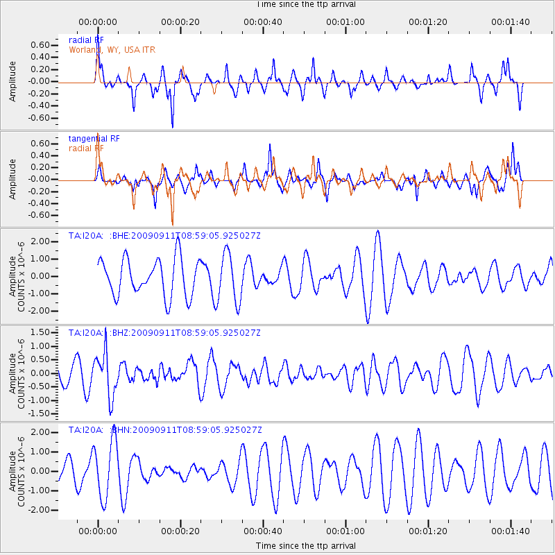
I20A Worland, WY, USA - Earthquake Result Viewer
*The percent match for this event was below the threshold and hence no stack was calculated.
| Earthquake location: |
Kuril Islands |
| Earthquake latitude/longitude: |
48.3/154.2 |
| Earthquake time(UTC): |
2009/09/11 (254) 08:49:11 GMT |
| Earthquake Depth: |
35 km |
| Earthquake Magnitude: |
5.8 MB, 5.0 MS, 5.6 MW, 5.6 MW |
| Earthquake Catalog/Contributor: |
WHDF/NEIC |
|
| Network: |
TA USArray Transportable Network (new EarthScope stations) |
| Station: |
I20A Worland, WY, USA |
| Lat/Lon: |
43.95 N/108.13 W |
| Elevation: |
1342 m |
|
| Distance: |
63.2 deg |
| Az: |
53.312 deg |
| Baz: |
312.147 deg |
| Ray Param: |
$rayparam |
*The percent match for this event was below the threshold and hence was not used in the summary stack. |
|
| Radial Match: |
55.352478 % |
| Radial Bump: |
299 |
| Transverse Match: |
66.0558 % |
| Transverse Bump: |
315 |
| SOD ConfigId: |
2622 |
| Insert Time: |
2010-03-06 02:33:49.862 +0000 |
| GWidth: |
2.5 |
| Max Bumps: |
400 |
| Tol: |
0.001 |
|
Signal To Noise
| Channel | StoN | STA | LTA |
| TA:I20A: :BHZ:20090911T08:59:05.925027Z | 3.020513 | 8.213424E-7 | 2.719215E-7 |
| TA:I20A: :BHN:20090911T08:59:05.925027Z | 1.8400848 | 1.5164932E-6 | 8.2414306E-7 |
| TA:I20A: :BHE:20090911T08:59:05.925027Z | 1.3065956 | 1.3847397E-6 | 1.0598075E-6 |
| Arrivals |
| Ps | |
| PpPs | |
| PsPs/PpSs | |


