You are here: Home > Network List > TA - USArray Transportable Network (new EarthScope stations) Stations List
> Station I20A Worland, WY, USA > Earthquake Result Viewer
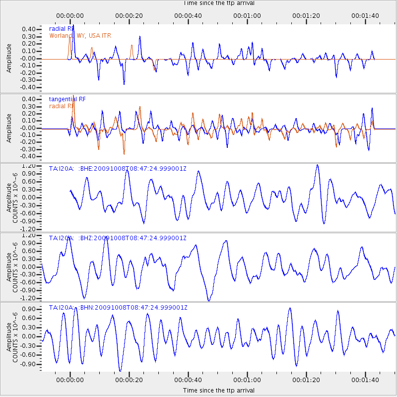
I20A Worland, WY, USA - Earthquake Result Viewer
*The percent match for this event was below the threshold and hence no stack was calculated.
| Earthquake location: |
Santa Cruz Islands |
| Earthquake latitude/longitude: |
-12.2/166.5 |
| Earthquake time(UTC): |
2009/10/08 (281) 08:34:36 GMT |
| Earthquake Depth: |
35 km |
| Earthquake Magnitude: |
6.0 MB |
| Earthquake Catalog/Contributor: |
WHDF/NEIC |
|
| Network: |
TA USArray Transportable Network (new EarthScope stations) |
| Station: |
I20A Worland, WY, USA |
| Lat/Lon: |
43.95 N/108.13 W |
| Elevation: |
1342 m |
|
| Distance: |
95.1 deg |
| Az: |
46.285 deg |
| Baz: |
258.033 deg |
| Ray Param: |
$rayparam |
*The percent match for this event was below the threshold and hence was not used in the summary stack. |
|
| Radial Match: |
72.89823 % |
| Radial Bump: |
400 |
| Transverse Match: |
54.1401 % |
| Transverse Bump: |
400 |
| SOD ConfigId: |
2622 |
| Insert Time: |
2010-03-06 02:33:55.660 +0000 |
| GWidth: |
2.5 |
| Max Bumps: |
400 |
| Tol: |
0.001 |
|
Signal To Noise
| Channel | StoN | STA | LTA |
| TA:I20A: :BHZ:20091008T08:47:24.999001Z | 1.2838615 | 7.4375566E-7 | 5.7931146E-7 |
| TA:I20A: :BHN:20091008T08:47:24.999001Z | 2.851801 | 6.645067E-7 | 2.33013E-7 |
| TA:I20A: :BHE:20091008T08:47:24.999001Z | 0.55728185 | 2.2686056E-7 | 4.070841E-7 |
| Arrivals |
| Ps | |
| PpPs | |
| PsPs/PpSs | |


