You are here: Home > Network List > TA - USArray Transportable Network (new EarthScope stations) Stations List
> Station I30M Mount Dempster, Yukon, CAN > Earthquake Result Viewer
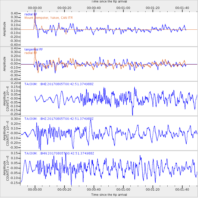
I30M Mount Dempster, Yukon, CAN - Earthquake Result Viewer
*The percent match for this event was below the threshold and hence no stack was calculated.
| Earthquake location: |
Mindanao, Philippines |
| Earthquake latitude/longitude: |
6.2/125.5 |
| Earthquake time(UTC): |
2017/08/05 (217) 00:30:41 GMT |
| Earthquake Depth: |
74 km |
| Earthquake Magnitude: |
5.8 Mww |
| Earthquake Catalog/Contributor: |
NEIC PDE/us |
|
| Network: |
TA USArray Transportable Network (new EarthScope stations) |
| Station: |
I30M Mount Dempster, Yukon, CAN |
| Lat/Lon: |
65.22 N/136.38 W |
| Elevation: |
1399 m |
|
| Distance: |
87.8 deg |
| Az: |
24.674 deg |
| Baz: |
279.968 deg |
| Ray Param: |
$rayparam |
*The percent match for this event was below the threshold and hence was not used in the summary stack. |
|
| Radial Match: |
74.31694 % |
| Radial Bump: |
400 |
| Transverse Match: |
60.86228 % |
| Transverse Bump: |
400 |
| SOD ConfigId: |
13570011 |
| Insert Time: |
2019-04-28 12:56:03.954 +0000 |
| GWidth: |
2.5 |
| Max Bumps: |
400 |
| Tol: |
0.001 |
|
Signal To Noise
| Channel | StoN | STA | LTA |
| TA:I30M: :BHZ:20170805T00:42:51.374988Z | 3.1009922 | 1.3751806E-7 | 4.4346468E-8 |
| TA:I30M: :BHN:20170805T00:42:51.374988Z | 0.8004639 | 3.9342467E-8 | 4.914958E-8 |
| TA:I30M: :BHE:20170805T00:42:51.374988Z | 1.0903368 | 4.445798E-8 | 4.077454E-8 |
| Arrivals |
| Ps | |
| PpPs | |
| PsPs/PpSs | |


