You are here: Home > Network List > TA - USArray Transportable Network (new EarthScope stations) Stations List
> Station I20A Worland, WY, USA > Earthquake Result Viewer
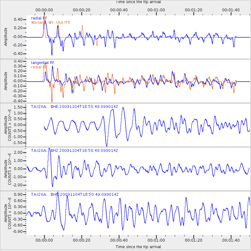
I20A Worland, WY, USA - Earthquake Result Viewer
*The percent match for this event was below the threshold and hence no stack was calculated.
| Earthquake location: |
Azores Islands Region |
| Earthquake latitude/longitude: |
36.2/-33.9 |
| Earthquake time(UTC): |
2009/11/04 (308) 18:41:44 GMT |
| Earthquake Depth: |
10 km |
| Earthquake Magnitude: |
5.7 MB, 5.6 MS, 5.9 MW, 5.8 MW |
| Earthquake Catalog/Contributor: |
WHDF/NEIC |
|
| Network: |
TA USArray Transportable Network (new EarthScope stations) |
| Station: |
I20A Worland, WY, USA |
| Lat/Lon: |
43.95 N/108.13 W |
| Elevation: |
1342 m |
|
| Distance: |
55.6 deg |
| Az: |
302.601 deg |
| Baz: |
70.728 deg |
| Ray Param: |
$rayparam |
*The percent match for this event was below the threshold and hence was not used in the summary stack. |
|
| Radial Match: |
79.37514 % |
| Radial Bump: |
326 |
| Transverse Match: |
70.44158 % |
| Transverse Bump: |
383 |
| SOD ConfigId: |
2622 |
| Insert Time: |
2010-03-06 02:34:06.832 +0000 |
| GWidth: |
2.5 |
| Max Bumps: |
400 |
| Tol: |
0.001 |
|
Signal To Noise
| Channel | StoN | STA | LTA |
| TA:I20A: :BHZ:20091104T18:50:49.099014Z | 8.116925 | 1.3803052E-6 | 1.7005272E-7 |
| TA:I20A: :BHN:20091104T18:50:49.099014Z | 1.6025631 | 2.8368945E-7 | 1.7702233E-7 |
| TA:I20A: :BHE:20091104T18:50:49.099014Z | 2.3415396 | 8.104888E-7 | 3.46135E-7 |
| Arrivals |
| Ps | |
| PpPs | |
| PsPs/PpSs | |


