You are here: Home > Network List > TA - USArray Transportable Network (new EarthScope stations) Stations List
> Station I20A Worland, WY, USA > Earthquake Result Viewer
I20A Worland, WY, USA - Earthquake Result Viewer
*The percent match for this event was below the threshold and hence no stack was calculated.
| Earthquake location: |
Hokkaido, Japan Region |
| Earthquake latitude/longitude: |
42.6/142.1 |
| Earthquake time(UTC): |
2009/02/28 (059) 00:35:56 GMT |
| Earthquake Depth: |
105 km |
| Earthquake Magnitude: |
5.5 MB, 5.5 MW, 5.5 MW |
| Earthquake Catalog/Contributor: |
WHDF/NEIC |
|
| Network: |
TA USArray Transportable Network (new EarthScope stations) |
| Station: |
I20A Worland, WY, USA |
| Lat/Lon: |
43.95 N/108.13 W |
| Elevation: |
1342 m |
|
| Distance: |
73.4 deg |
| Az: |
45.185 deg |
| Baz: |
313.526 deg |
| Ray Param: |
$rayparam |
*The percent match for this event was below the threshold and hence was not used in the summary stack. |
|
| Radial Match: |
64.32375 % |
| Radial Bump: |
400 |
| Transverse Match: |
65.27805 % |
| Transverse Bump: |
386 |
| SOD ConfigId: |
2658 |
| Insert Time: |
2010-03-06 02:34:11.395 +0000 |
| GWidth: |
2.5 |
| Max Bumps: |
400 |
| Tol: |
0.001 |
|
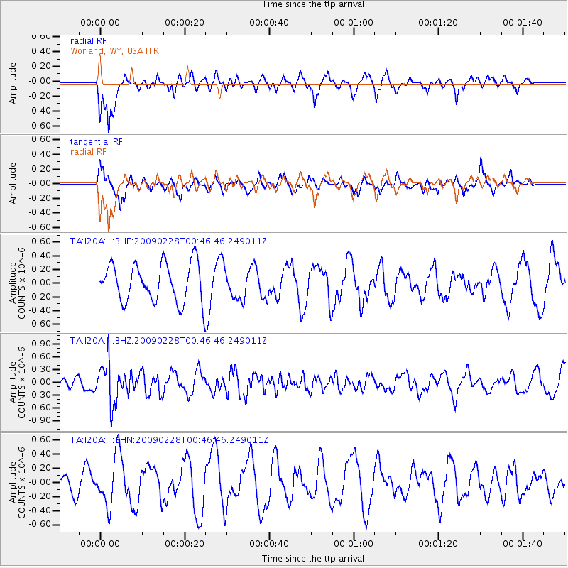
Signal To Noise
| Channel | StoN | STA | LTA |
| TA:I20A: :BHZ:20090228T00:46:46.249011Z | 4.0595493 | 5.019433E-7 | 1.236451E-7 |
| TA:I20A: :BHN:20090228T00:46:46.249011Z | 2.111546 | 3.7369105E-7 | 1.7697509E-7 |
| TA:I20A: :BHE:20090228T00:46:46.249011Z | 0.7918646 | 2.2284681E-7 | 2.8142037E-7 |
| Arrivals |
| Ps | |
| PpPs | |
| PsPs/PpSs | |


