You are here: Home > Network List > TA - USArray Transportable Network (new EarthScope stations) Stations List
> Station I20A Worland, WY, USA > Earthquake Result Viewer
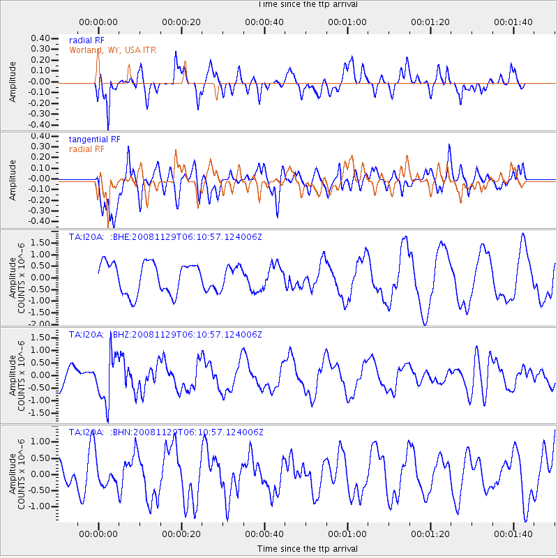
I20A Worland, WY, USA - Earthquake Result Viewer
*The percent match for this event was below the threshold and hence no stack was calculated.
| Earthquake location: |
Fiji Islands Region |
| Earthquake latitude/longitude: |
-18.7/-177.7 |
| Earthquake time(UTC): |
2008/11/29 (334) 05:59:16 GMT |
| Earthquake Depth: |
386 km |
| Earthquake Magnitude: |
5.7 MB, 6.0 MW, 5.9 MW |
| Earthquake Catalog/Contributor: |
WHDF/NEIC |
|
| Network: |
TA USArray Transportable Network (new EarthScope stations) |
| Station: |
I20A Worland, WY, USA |
| Lat/Lon: |
43.95 N/108.13 W |
| Elevation: |
1342 m |
|
| Distance: |
88.9 deg |
| Az: |
42.612 deg |
| Baz: |
242.684 deg |
| Ray Param: |
$rayparam |
*The percent match for this event was below the threshold and hence was not used in the summary stack. |
|
| Radial Match: |
44.81405 % |
| Radial Bump: |
400 |
| Transverse Match: |
75.86494 % |
| Transverse Bump: |
400 |
| SOD ConfigId: |
2658 |
| Insert Time: |
2010-03-06 02:34:12.031 +0000 |
| GWidth: |
2.5 |
| Max Bumps: |
400 |
| Tol: |
0.001 |
|
Signal To Noise
| Channel | StoN | STA | LTA |
| TA:I20A: :BHZ:20081129T06:10:57.124006Z | 2.7441375 | 9.532271E-7 | 3.4736854E-7 |
| TA:I20A: :BHN:20081129T06:10:57.124006Z | 0.82341105 | 3.900634E-7 | 4.7371648E-7 |
| TA:I20A: :BHE:20081129T06:10:57.124006Z | 0.69674766 | 4.6022197E-7 | 6.605289E-7 |
| Arrivals |
| Ps | |
| PpPs | |
| PsPs/PpSs | |


