You are here: Home > Network List > TA - USArray Transportable Network (new EarthScope stations) Stations List
> Station I20A Worland, WY, USA > Earthquake Result Viewer
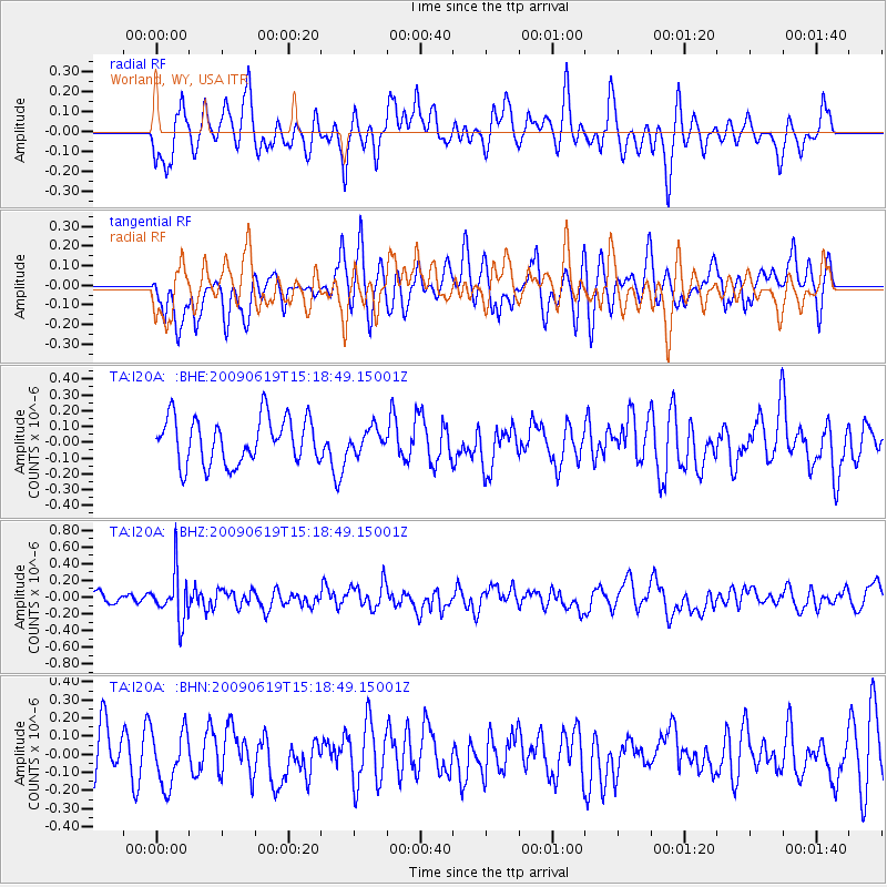
I20A Worland, WY, USA - Earthquake Result Viewer
*The percent match for this event was below the threshold and hence no stack was calculated.
| Earthquake location: |
Mariana Islands |
| Earthquake latitude/longitude: |
14.1/145.2 |
| Earthquake time(UTC): |
2009/06/19 (170) 15:06:24 GMT |
| Earthquake Depth: |
114 km |
| Earthquake Magnitude: |
5.5 MB, 5.5 MW |
| Earthquake Catalog/Contributor: |
WHDF/NEIC |
|
| Network: |
TA USArray Transportable Network (new EarthScope stations) |
| Station: |
I20A Worland, WY, USA |
| Lat/Lon: |
43.95 N/108.13 W |
| Elevation: |
1342 m |
|
| Distance: |
92.0 deg |
| Az: |
43.811 deg |
| Baz: |
291.556 deg |
| Ray Param: |
$rayparam |
*The percent match for this event was below the threshold and hence was not used in the summary stack. |
|
| Radial Match: |
54.40466 % |
| Radial Bump: |
400 |
| Transverse Match: |
51.716244 % |
| Transverse Bump: |
400 |
| SOD ConfigId: |
2648 |
| Insert Time: |
2010-03-06 02:34:20.992 +0000 |
| GWidth: |
2.5 |
| Max Bumps: |
400 |
| Tol: |
0.001 |
|
Signal To Noise
| Channel | StoN | STA | LTA |
| TA:I20A: :BHZ:20090619T15:18:49.15001Z | 3.947995 | 2.8617075E-7 | 7.248508E-8 |
| TA:I20A: :BHN:20090619T15:18:49.15001Z | 1.3838925 | 1.530682E-7 | 1.10607E-7 |
| TA:I20A: :BHE:20090619T15:18:49.15001Z | 0.4749669 | 6.913454E-8 | 1.4555654E-7 |
| Arrivals |
| Ps | |
| PpPs | |
| PsPs/PpSs | |


