You are here: Home > Network List > TA - USArray Transportable Network (new EarthScope stations) Stations List
> Station I20A Worland, WY, USA > Earthquake Result Viewer
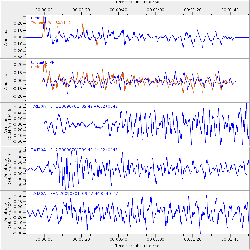
I20A Worland, WY, USA - Earthquake Result Viewer
*The percent match for this event was below the threshold and hence no stack was calculated.
| Earthquake location: |
Crete, Greece |
| Earthquake latitude/longitude: |
34.2/25.5 |
| Earthquake time(UTC): |
2009/07/01 (182) 09:30:10 GMT |
| Earthquake Depth: |
19 km |
| Earthquake Magnitude: |
6.1 MB, 6.3 MS, 6.4 MW, 6.4 MW |
| Earthquake Catalog/Contributor: |
WHDF/NEIC |
|
| Network: |
TA USArray Transportable Network (new EarthScope stations) |
| Station: |
I20A Worland, WY, USA |
| Lat/Lon: |
43.95 N/108.13 W |
| Elevation: |
1342 m |
|
| Distance: |
91.5 deg |
| Az: |
328.45 deg |
| Baz: |
36.919 deg |
| Ray Param: |
$rayparam |
*The percent match for this event was below the threshold and hence was not used in the summary stack. |
|
| Radial Match: |
74.31968 % |
| Radial Bump: |
398 |
| Transverse Match: |
69.60901 % |
| Transverse Bump: |
400 |
| SOD ConfigId: |
2648 |
| Insert Time: |
2010-03-06 02:34:26.193 +0000 |
| GWidth: |
2.5 |
| Max Bumps: |
400 |
| Tol: |
0.001 |
|
Signal To Noise
| Channel | StoN | STA | LTA |
| TA:I20A: :BHZ:20090701T09:42:44.024014Z | 3.4840832 | 2.9885774E-7 | 8.577801E-8 |
| TA:I20A: :BHN:20090701T09:42:44.024014Z | 1.0871695 | 1.8171094E-7 | 1.6714131E-7 |
| TA:I20A: :BHE:20090701T09:42:44.024014Z | 0.77472353 | 1.07340384E-7 | 1.3855316E-7 |
| Arrivals |
| Ps | |
| PpPs | |
| PsPs/PpSs | |


