You are here: Home > Network List > TA - USArray Transportable Network (new EarthScope stations) Stations List
> Station M16K Timber Creek, AK, USA > Earthquake Result Viewer
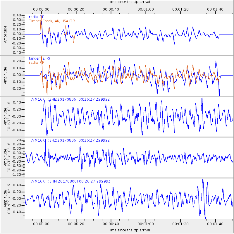
M16K Timber Creek, AK, USA - Earthquake Result Viewer
*The percent match for this event was below the threshold and hence no stack was calculated.
| Earthquake location: |
Solomon Islands |
| Earthquake latitude/longitude: |
-10.3/161.5 |
| Earthquake time(UTC): |
2017/08/06 (218) 00:15:10 GMT |
| Earthquake Depth: |
73 km |
| Earthquake Magnitude: |
5.7 Mww |
| Earthquake Catalog/Contributor: |
NEIC PDE/us |
|
| Network: |
TA USArray Transportable Network (new EarthScope stations) |
| Station: |
M16K Timber Creek, AK, USA |
| Lat/Lon: |
61.02 N/158.96 W |
| Elevation: |
394 m |
|
| Distance: |
77.6 deg |
| Az: |
18.516 deg |
| Baz: |
219.929 deg |
| Ray Param: |
$rayparam |
*The percent match for this event was below the threshold and hence was not used in the summary stack. |
|
| Radial Match: |
62.906914 % |
| Radial Bump: |
383 |
| Transverse Match: |
53.995693 % |
| Transverse Bump: |
388 |
| SOD ConfigId: |
13570011 |
| Insert Time: |
2019-04-28 13:02:38.769 +0000 |
| GWidth: |
2.5 |
| Max Bumps: |
400 |
| Tol: |
0.001 |
|
Signal To Noise
| Channel | StoN | STA | LTA |
| TA:M16K: :BHZ:20170806T00:26:27.29999Z | 2.4740953 | 4.202685E-7 | 1.6986753E-7 |
| TA:M16K: :BHN:20170806T00:26:27.29999Z | 1.0747064 | 1.2175657E-7 | 1.1329286E-7 |
| TA:M16K: :BHE:20170806T00:26:27.29999Z | 0.50109774 | 1.15193735E-7 | 2.2988276E-7 |
| Arrivals |
| Ps | |
| PpPs | |
| PsPs/PpSs | |


