H26A Fairpoint, SD, USA - Earthquake Result Viewer
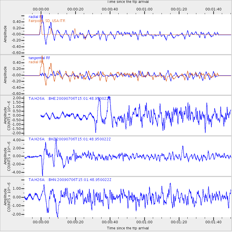
Earthquake location: Rat Islands, Aleutian Islands
Earthquake latitude/longitude: 50.4/177.0
Earthquake time(UTC): 2009/07/06 (187) 14:53:12 GMT
Earthquake Depth: 22 km
Earthquake Magnitude: 6.0 MB, 5.8 MS, 6.1 MW, 6.0 MW
Earthquake Catalog/Contributor: WHDF/NEIC
Network: TA USArray Transportable Network (new EarthScope stations)
Station: H26A Fairpoint, SD, USA
Lat/Lon: 44.62 N/102.77 W
Elevation: 879 m
Distance: 52.0 deg
Az: 63.267 deg
Baz: 306.896 deg
Ray Param: 0.0670088
Estimated Moho Depth: 16.5 km
Estimated Crust Vp/Vs: 1.60
Assumed Crust Vp: 6.242 km/s
Estimated Crust Vs: 3.901 km/s
Estimated Crust Poisson's Ratio: 0.18
Radial Match: 83.90945 %
Radial Bump: 400
Transverse Match: 72.834984 %
Transverse Bump: 400
SOD ConfigId: 2648
Insert Time: 2010-03-06 02:35:25.429 +0000
GWidth: 2.5
Max Bumps: 400
Tol: 0.001

Signal To Noise

ChannelStoNSTALTA
TA:H26A: :BHZ:20090706T15:01:48.950022Z9.0275521.7981415E-61.9918375E-7
TA:H26A: :BHN:20090706T15:01:48.950022Z4.306979.0903626E-72.1106166E-7
TA:H26A: :BHE:20090706T15:01:48.950022Z4.8476211.0121416E-62.0879142E-7
Arrivals
Ps1.7 SECOND
PpPs6.5 SECOND
PsPs/PpSs8.2 SECOND