You are here: Home > Network List > GS - US Geological Survey Networks Stations List
> Station OK031 2598 S. Brethren Rd., Cushing, OK, USA > Earthquake Result Viewer
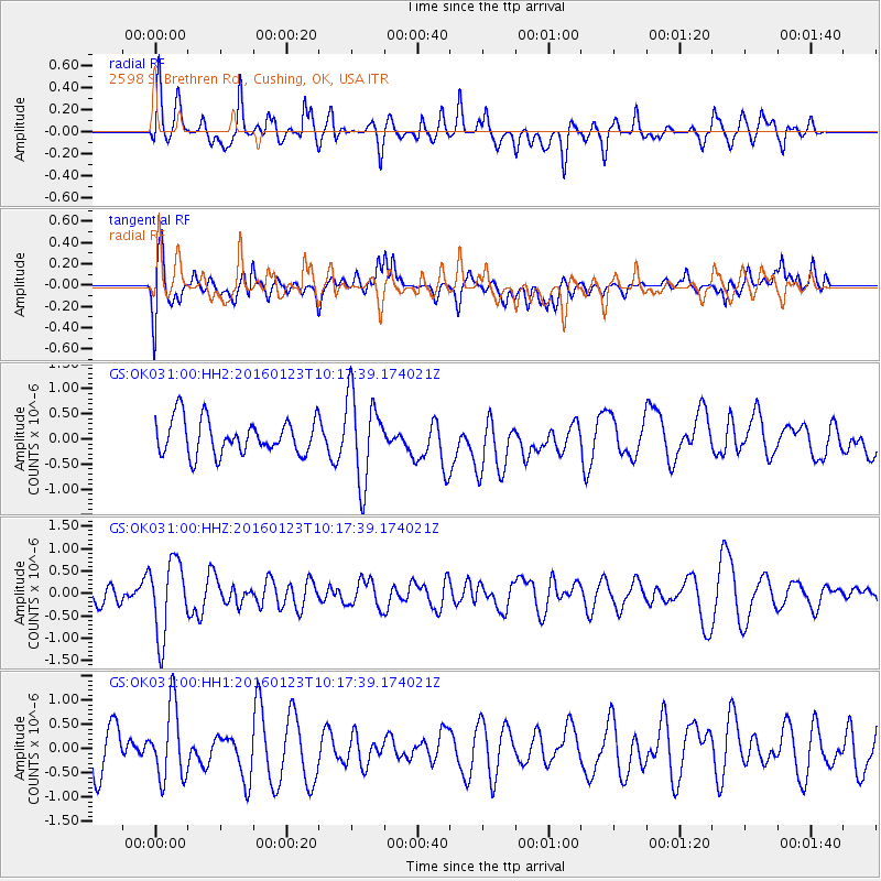
OK031 2598 S. Brethren Rd., Cushing, OK, USA - Earthquake Result Viewer
*The percent match for this event was below the threshold and hence no stack was calculated.
| Earthquake location: |
Easter Island Region |
| Earthquake latitude/longitude: |
-22.4/-114.0 |
| Earthquake time(UTC): |
2016/01/23 (023) 10:08:01 GMT |
| Earthquake Depth: |
10 km |
| Earthquake Magnitude: |
5.5 MB |
| Earthquake Catalog/Contributor: |
NEIC PDE/NEIC COMCAT |
|
| Network: |
GS US Geological Survey Networks |
| Station: |
OK031 2598 S. Brethren Rd., Cushing, OK, USA |
| Lat/Lon: |
35.95 N/96.84 W |
| Elevation: |
290 m |
|
| Distance: |
60.2 deg |
| Az: |
15.977 deg |
| Baz: |
198.3 deg |
| Ray Param: |
$rayparam |
*The percent match for this event was below the threshold and hence was not used in the summary stack. |
|
| Radial Match: |
53.89813 % |
| Radial Bump: |
400 |
| Transverse Match: |
53.648785 % |
| Transverse Bump: |
400 |
| SOD ConfigId: |
1399611 |
| Insert Time: |
2016-02-06 10:27:10.448 +0000 |
| GWidth: |
2.5 |
| Max Bumps: |
400 |
| Tol: |
0.001 |
|
Signal To Noise
| Channel | StoN | STA | LTA |
| GS:OK031:00:HHZ:20160123T10:17:39.174021Z | 3.1019998 | 8.441585E-7 | 2.7213363E-7 |
| GS:OK031:00:HH1:20160123T10:17:39.174021Z | 1.634953 | 7.507316E-7 | 4.5917625E-7 |
| GS:OK031:00:HH2:20160123T10:17:39.174021Z | 2.487405 | 8.6953344E-7 | 3.495745E-7 |
| Arrivals |
| Ps | |
| PpPs | |
| PsPs/PpSs | |


