You are here: Home > Network List > TA - USArray Transportable Network (new EarthScope stations) Stations List
> Station H26A Fairpoint, SD, USA > Earthquake Result Viewer
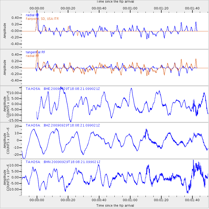
H26A Fairpoint, SD, USA - Earthquake Result Viewer
*The percent match for this event was below the threshold and hence no stack was calculated.
| Earthquake location: |
Tonga Islands |
| Earthquake latitude/longitude: |
-15.4/-173.2 |
| Earthquake time(UTC): |
2009/09/29 (272) 17:56:05 GMT |
| Earthquake Depth: |
10 km |
| Earthquake Magnitude: |
6.0 MB |
| Earthquake Catalog/Contributor: |
WHDF/NEIC |
|
| Network: |
TA USArray Transportable Network (new EarthScope stations) |
| Station: |
H26A Fairpoint, SD, USA |
| Lat/Lon: |
44.62 N/102.77 W |
| Elevation: |
879 m |
|
| Distance: |
87.3 deg |
| Az: |
42.336 deg |
| Baz: |
245.475 deg |
| Ray Param: |
$rayparam |
*The percent match for this event was below the threshold and hence was not used in the summary stack. |
|
| Radial Match: |
52.75152 % |
| Radial Bump: |
400 |
| Transverse Match: |
42.406178 % |
| Transverse Bump: |
400 |
| SOD ConfigId: |
2622 |
| Insert Time: |
2010-03-06 02:35:33.926 +0000 |
| GWidth: |
2.5 |
| Max Bumps: |
400 |
| Tol: |
0.001 |
|
Signal To Noise
| Channel | StoN | STA | LTA |
| TA:H26A: :BHZ:20090929T18:08:21.099021Z | 0.7703249 | 1.0688431E-5 | 1.3875225E-5 |
| TA:H26A: :BHN:20090929T18:08:21.099021Z | 1.3691216 | 5.99173E-6 | 4.376332E-6 |
| TA:H26A: :BHE:20090929T18:08:21.099021Z | 0.6300567 | 5.2737705E-6 | 8.370312E-6 |
| Arrivals |
| Ps | |
| PpPs | |
| PsPs/PpSs | |


