You are here: Home > Network List > GS - US Geological Survey Networks Stations List
> Station KAN10 Keim Farm, Anthony, KS, USA > Earthquake Result Viewer
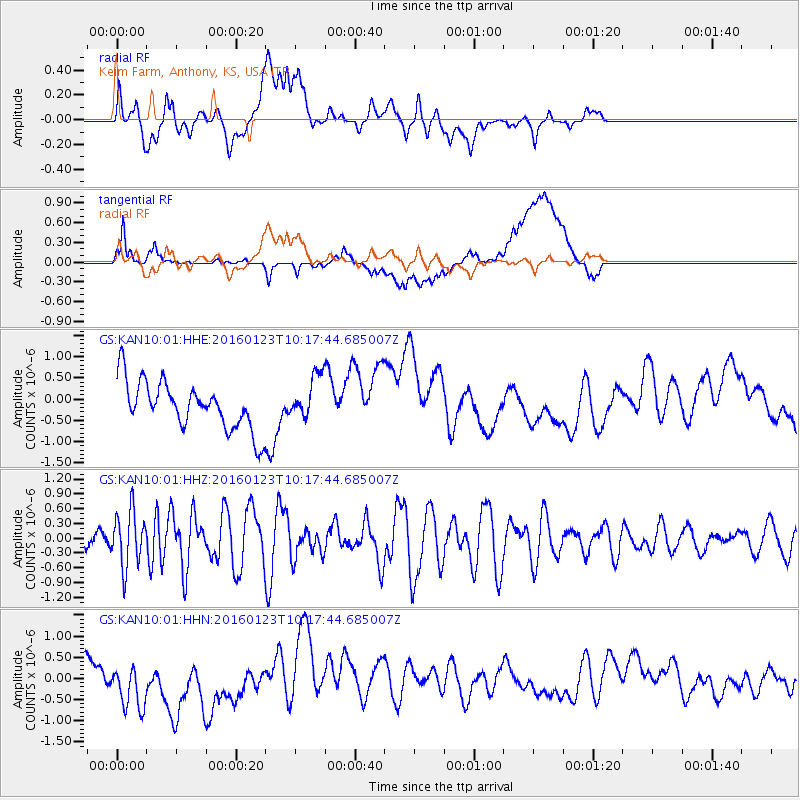
KAN10 Keim Farm, Anthony, KS, USA - Earthquake Result Viewer
*The percent match for this event was below the threshold and hence no stack was calculated.
| Earthquake location: |
Easter Island Region |
| Earthquake latitude/longitude: |
-22.4/-114.0 |
| Earthquake time(UTC): |
2016/01/23 (023) 10:08:01 GMT |
| Earthquake Depth: |
10 km |
| Earthquake Magnitude: |
5.5 MB |
| Earthquake Catalog/Contributor: |
NEIC PDE/NEIC COMCAT |
|
| Network: |
GS US Geological Survey Networks |
| Station: |
KAN10 Keim Farm, Anthony, KS, USA |
| Lat/Lon: |
37.12 N/98.10 W |
| Elevation: |
417 m |
|
| Distance: |
61.0 deg |
| Az: |
14.466 deg |
| Baz: |
196.815 deg |
| Ray Param: |
$rayparam |
*The percent match for this event was below the threshold and hence was not used in the summary stack. |
|
| Radial Match: |
57.872723 % |
| Radial Bump: |
400 |
| Transverse Match: |
39.34043 % |
| Transverse Bump: |
400 |
| SOD ConfigId: |
1399611 |
| Insert Time: |
2016-02-06 10:27:33.559 +0000 |
| GWidth: |
2.5 |
| Max Bumps: |
400 |
| Tol: |
0.001 |
|
Signal To Noise
| Channel | StoN | STA | LTA |
| GS:KAN10:01:HHZ:20160123T10:17:44.685007Z | 1.8806442 | 5.554468E-7 | 2.9534922E-7 |
| GS:KAN10:01:HHN:20160123T10:17:44.685007Z | 2.276114 | 6.836622E-7 | 3.003638E-7 |
| GS:KAN10:01:HHE:20160123T10:17:44.685007Z | 0.9247181 | 5.155165E-7 | 5.5748507E-7 |
| Arrivals |
| Ps | |
| PpPs | |
| PsPs/PpSs | |


