You are here: Home > Network List > TA - USArray Transportable Network (new EarthScope stations) Stations List
> Station H26A Fairpoint, SD, USA > Earthquake Result Viewer
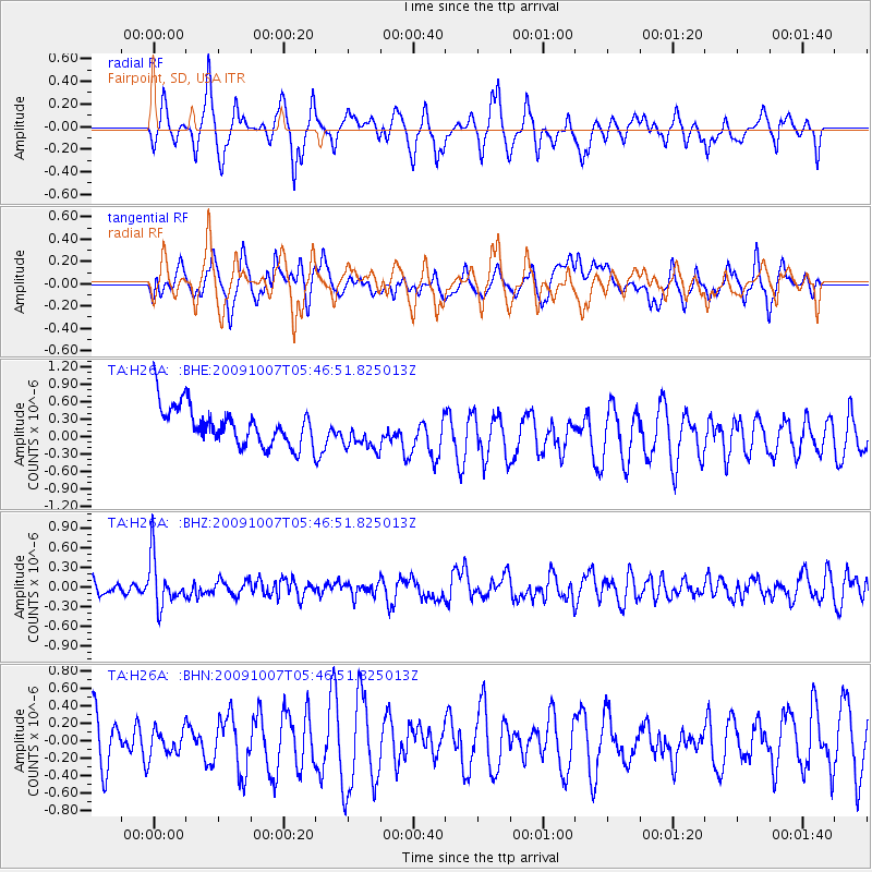
H26A Fairpoint, SD, USA - Earthquake Result Viewer
*The percent match for this event was below the threshold and hence no stack was calculated.
| Earthquake location: |
Rat Islands, Aleutian Islands |
| Earthquake latitude/longitude: |
52.2/178.1 |
| Earthquake time(UTC): |
2009/10/07 (280) 05:38:37 GMT |
| Earthquake Depth: |
138 km |
| Earthquake Magnitude: |
5.6 MB, 5.6 MW, 5.6 MW |
| Earthquake Catalog/Contributor: |
WHDF/NEIC |
|
| Network: |
TA USArray Transportable Network (new EarthScope stations) |
| Station: |
H26A Fairpoint, SD, USA |
| Lat/Lon: |
44.62 N/102.77 W |
| Elevation: |
879 m |
|
| Distance: |
50.7 deg |
| Az: |
65.103 deg |
| Baz: |
308.514 deg |
| Ray Param: |
$rayparam |
*The percent match for this event was below the threshold and hence was not used in the summary stack. |
|
| Radial Match: |
36.5944 % |
| Radial Bump: |
344 |
| Transverse Match: |
33.856087 % |
| Transverse Bump: |
400 |
| SOD ConfigId: |
2622 |
| Insert Time: |
2010-03-06 02:35:38.637 +0000 |
| GWidth: |
2.5 |
| Max Bumps: |
400 |
| Tol: |
0.001 |
|
Signal To Noise
| Channel | StoN | STA | LTA |
| TA:H26A: :BHZ:20091007T05:46:51.825013Z | 3.4042006 | 3.6997423E-7 | 1.0868168E-7 |
| TA:H26A: :BHN:20091007T05:46:51.825013Z | 0.5625766 | 1.5219922E-7 | 2.7053957E-7 |
| TA:H26A: :BHE:20091007T05:46:51.825013Z | 0.96852773 | 3.1956807E-7 | 3.2995243E-7 |
| Arrivals |
| Ps | |
| PpPs | |
| PsPs/PpSs | |


