You are here: Home > Network List > GS - US Geological Survey Networks Stations List
> Station KAN11 Stewart Ranch, Harper County, KS, USA > Earthquake Result Viewer
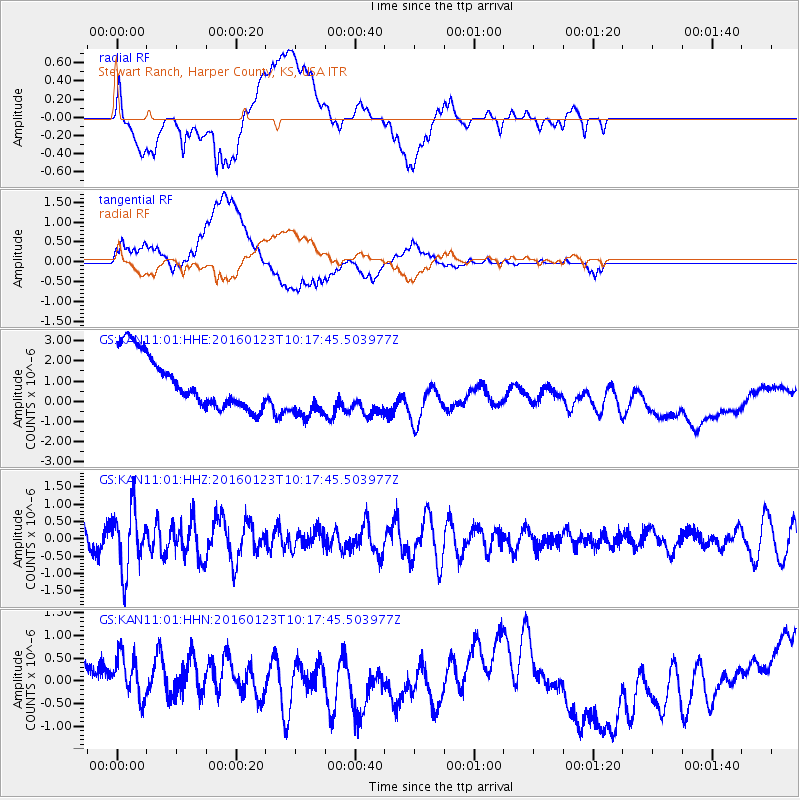
KAN11 Stewart Ranch, Harper County, KS, USA - Earthquake Result Viewer
*The percent match for this event was below the threshold and hence no stack was calculated.
| Earthquake location: |
Easter Island Region |
| Earthquake latitude/longitude: |
-22.4/-114.0 |
| Earthquake time(UTC): |
2016/01/23 (023) 10:08:01 GMT |
| Earthquake Depth: |
10 km |
| Earthquake Magnitude: |
5.5 MB |
| Earthquake Catalog/Contributor: |
NEIC PDE/NEIC COMCAT |
|
| Network: |
GS US Geological Survey Networks |
| Station: |
KAN11 Stewart Ranch, Harper County, KS, USA |
| Lat/Lon: |
37.21 N/97.91 W |
| Elevation: |
410 m |
|
| Distance: |
61.2 deg |
| Az: |
14.598 deg |
| Baz: |
196.988 deg |
| Ray Param: |
$rayparam |
*The percent match for this event was below the threshold and hence was not used in the summary stack. |
|
| Radial Match: |
35.649544 % |
| Radial Bump: |
400 |
| Transverse Match: |
31.792414 % |
| Transverse Bump: |
400 |
| SOD ConfigId: |
1399611 |
| Insert Time: |
2016-02-06 10:27:35.708 +0000 |
| GWidth: |
2.5 |
| Max Bumps: |
400 |
| Tol: |
0.001 |
|
Signal To Noise
| Channel | StoN | STA | LTA |
| GS:KAN11:01:HHZ:20160123T10:17:45.503977Z | 2.8852265 | 8.866654E-7 | 3.0731226E-7 |
| GS:KAN11:01:HHN:20160123T10:17:45.503977Z | 0.77337617 | 7.955982E-7 | 1.0287338E-6 |
| GS:KAN11:01:HHE:20160123T10:17:45.503977Z | 1.1055174 | 1.4334914E-6 | 1.2966702E-6 |
| Arrivals |
| Ps | |
| PpPs | |
| PsPs/PpSs | |


