You are here: Home > Network List > TA - USArray Transportable Network (new EarthScope stations) Stations List
> Station H26A Fairpoint, SD, USA > Earthquake Result Viewer
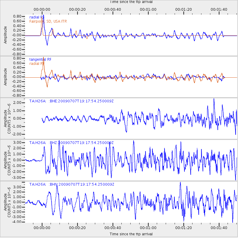
H26A Fairpoint, SD, USA - Earthquake Result Viewer
*The percent match for this event was below the threshold and hence no stack was calculated.
| Earthquake location: |
Baffin Bay |
| Earthquake latitude/longitude: |
75.4/-72.5 |
| Earthquake time(UTC): |
2009/07/07 (188) 19:11:46 GMT |
| Earthquake Depth: |
19 km |
| Earthquake Magnitude: |
5.9 MB, 5.7 MS, 6.1 MW, 6.0 MW |
| Earthquake Catalog/Contributor: |
WHDF/NEIC |
|
| Network: |
TA USArray Transportable Network (new EarthScope stations) |
| Station: |
H26A Fairpoint, SD, USA |
| Lat/Lon: |
44.62 N/102.77 W |
| Elevation: |
879 m |
|
| Distance: |
33.5 deg |
| Az: |
220.776 deg |
| Baz: |
13.458 deg |
| Ray Param: |
$rayparam |
*The percent match for this event was below the threshold and hence was not used in the summary stack. |
|
| Radial Match: |
79.84563 % |
| Radial Bump: |
400 |
| Transverse Match: |
64.13097 % |
| Transverse Bump: |
400 |
| SOD ConfigId: |
2648 |
| Insert Time: |
2010-03-06 02:35:42.090 +0000 |
| GWidth: |
2.5 |
| Max Bumps: |
400 |
| Tol: |
0.001 |
|
Signal To Noise
| Channel | StoN | STA | LTA |
| TA:H26A: :BHZ:20090707T19:17:54.250009Z | 10.203155 | 1.4467976E-6 | 1.4179905E-7 |
| TA:H26A: :BHN:20090707T19:17:54.250009Z | 4.4230456 | 1.0975858E-6 | 2.481516E-7 |
| TA:H26A: :BHE:20090707T19:17:54.250009Z | 1.0784469 | 2.0959311E-7 | 1.943472E-7 |
| Arrivals |
| Ps | |
| PpPs | |
| PsPs/PpSs | |


