You are here: Home > Network List > TA - USArray Transportable Network (new EarthScope stations) Stations List
> Station G16K Koyuk River, AK, USA > Earthquake Result Viewer
G16K Koyuk River, AK, USA - Earthquake Result Viewer

| Earthquake location: |
New Britain Region, P.N.G. |
| Earthquake latitude/longitude: |
-5.4/151.6 |
| Earthquake time(UTC): |
2017/08/07 (219) 06:26:44 GMT |
| Earthquake Depth: |
35 km |
| Earthquake Magnitude: |
5.8 Mww |
| Earthquake Catalog/Contributor: |
NEIC PDE/us |
|
| Network: |
TA USArray Transportable Network (new EarthScope stations) |
| Station: |
G16K Koyuk River, AK, USA |
| Lat/Lon: |
65.39 N/162.35 W |
| Elevation: |
169 m |
|
| Distance: |
78.2 deg |
| Az: |
17.947 deg |
| Baz: |
227.113 deg |
| Ray Param: |
0.049742926 |
| Estimated Moho Depth: |
30.5 km |
| Estimated Crust Vp/Vs: |
1.86 |
| Assumed Crust Vp: |
6.276 km/s |
| Estimated Crust Vs: |
3.37 km/s |
| Estimated Crust Poisson's Ratio: |
0.30 |
|
| Radial Match: |
82.909805 % |
| Radial Bump: |
400 |
| Transverse Match: |
65.51576 % |
| Transverse Bump: |
400 |
| SOD ConfigId: |
13570011 |
| Insert Time: |
2019-04-28 13:10:59.443 +0000 |
| GWidth: |
2.5 |
| Max Bumps: |
400 |
| Tol: |
0.001 |
|
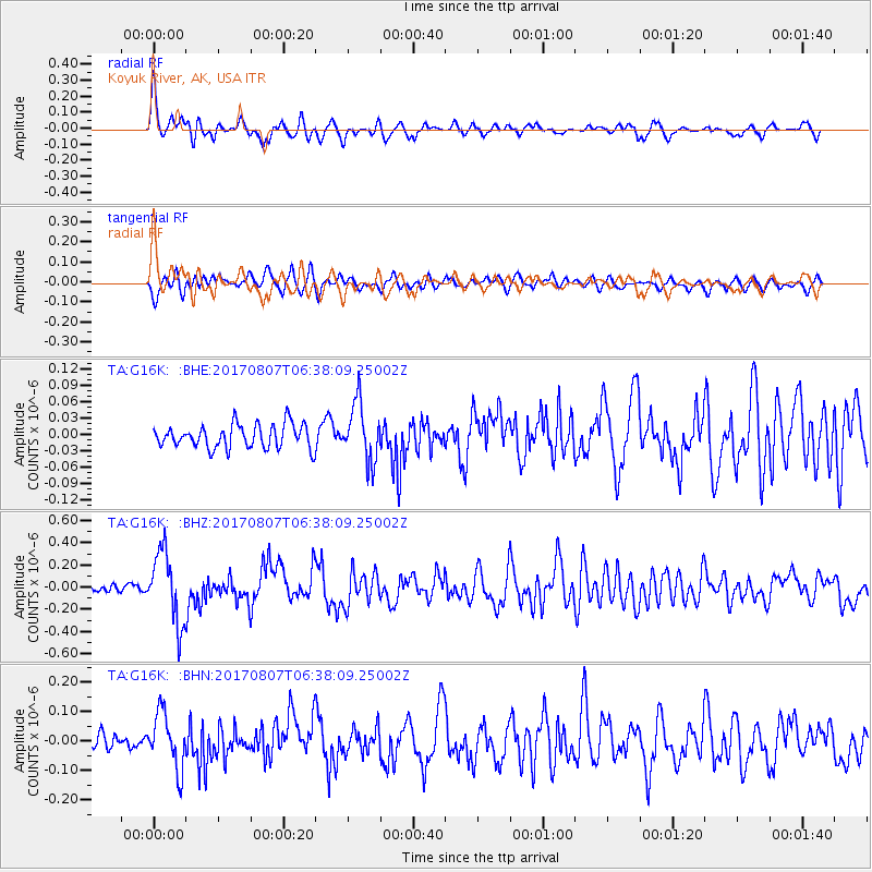
Signal To Noise
| Channel | StoN | STA | LTA |
| TA:G16K: :BHZ:20170807T06:38:09.25002Z | 7.728024 | 3.2048223E-7 | 4.147014E-8 |
| TA:G16K: :BHN:20170807T06:38:09.25002Z | 2.915862 | 9.408217E-8 | 3.2265643E-8 |
| TA:G16K: :BHE:20170807T06:38:09.25002Z | 2.4525635 | 5.2701626E-8 | 2.1488384E-8 |
| Arrivals |
| Ps | 4.3 SECOND |
| PpPs | 14 SECOND |
| PsPs/PpSs | 18 SECOND |


