You are here: Home > Network List > TA - USArray Transportable Network (new EarthScope stations) Stations List
> Station H31M Peel River, Yukon, CAN > Earthquake Result Viewer
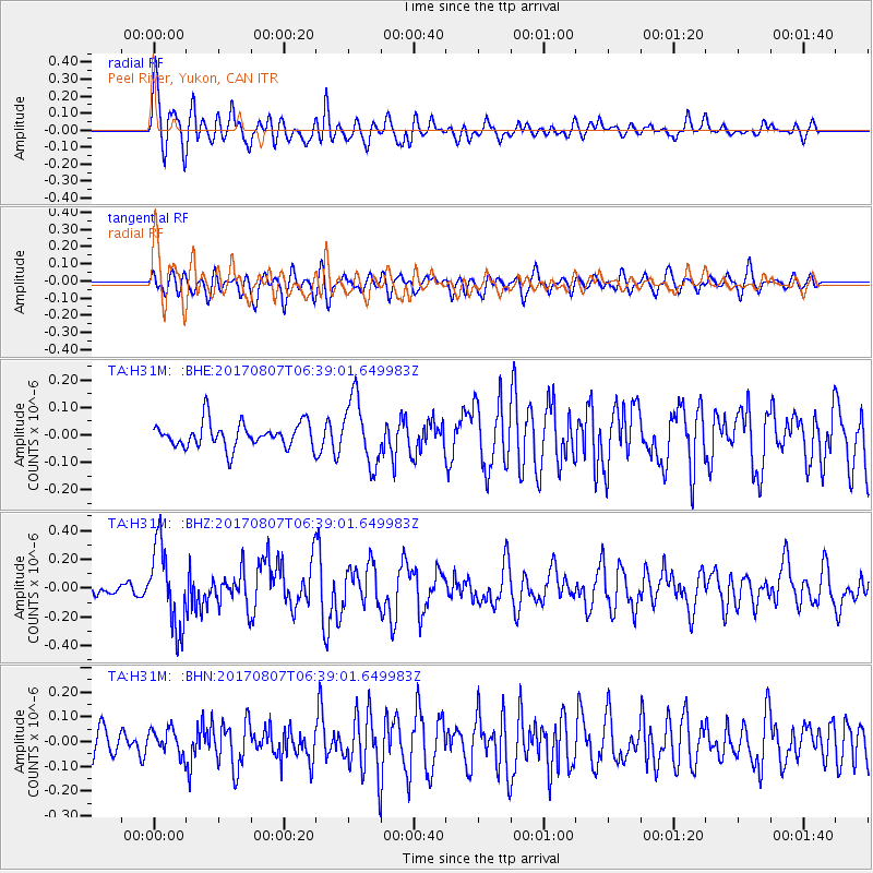
H31M Peel River, Yukon, CAN - Earthquake Result Viewer
*The percent match for this event was below the threshold and hence no stack was calculated.
| Earthquake location: |
New Britain Region, P.N.G. |
| Earthquake latitude/longitude: |
-5.4/151.6 |
| Earthquake time(UTC): |
2017/08/07 (219) 06:26:44 GMT |
| Earthquake Depth: |
35 km |
| Earthquake Magnitude: |
5.8 Mww |
| Earthquake Catalog/Contributor: |
NEIC PDE/us |
|
| Network: |
TA USArray Transportable Network (new EarthScope stations) |
| Station: |
H31M Peel River, Yukon, CAN |
| Lat/Lon: |
65.81 N/134.34 W |
| Elevation: |
642 m |
|
| Distance: |
88.4 deg |
| Az: |
23.361 deg |
| Baz: |
253.313 deg |
| Ray Param: |
$rayparam |
*The percent match for this event was below the threshold and hence was not used in the summary stack. |
|
| Radial Match: |
69.27538 % |
| Radial Bump: |
400 |
| Transverse Match: |
54.507076 % |
| Transverse Bump: |
400 |
| SOD ConfigId: |
13570011 |
| Insert Time: |
2019-04-28 13:11:14.829 +0000 |
| GWidth: |
2.5 |
| Max Bumps: |
400 |
| Tol: |
0.001 |
|
Signal To Noise
| Channel | StoN | STA | LTA |
| TA:H31M: :BHZ:20170807T06:39:01.649983Z | 5.3087125 | 2.8175236E-7 | 5.3073578E-8 |
| TA:H31M: :BHN:20170807T06:39:01.649983Z | 0.7197548 | 5.2348444E-8 | 7.273094E-8 |
| TA:H31M: :BHE:20170807T06:39:01.649983Z | 2.6430829 | 1.1984389E-7 | 4.5342464E-8 |
| Arrivals |
| Ps | |
| PpPs | |
| PsPs/PpSs | |


