You are here: Home > Network List > TA - USArray Transportable Network (new EarthScope stations) Stations List
> Station I17K Unalakleet, AK, USA > Earthquake Result Viewer
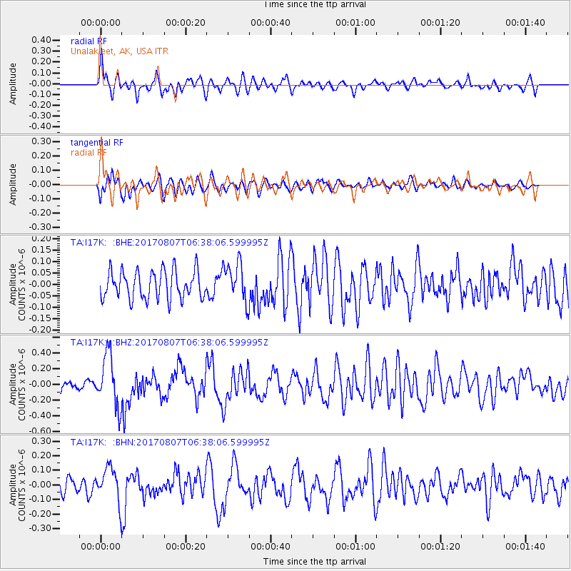
I17K Unalakleet, AK, USA - Earthquake Result Viewer
*The percent match for this event was below the threshold and hence no stack was calculated.
| Earthquake location: |
New Britain Region, P.N.G. |
| Earthquake latitude/longitude: |
-5.4/151.6 |
| Earthquake time(UTC): |
2017/08/07 (219) 06:26:44 GMT |
| Earthquake Depth: |
35 km |
| Earthquake Magnitude: |
5.8 Mww |
| Earthquake Catalog/Contributor: |
NEIC PDE/us |
|
| Network: |
TA USArray Transportable Network (new EarthScope stations) |
| Station: |
I17K Unalakleet, AK, USA |
| Lat/Lon: |
63.89 N/160.70 W |
| Elevation: |
105 m |
|
| Distance: |
77.7 deg |
| Az: |
19.586 deg |
| Baz: |
228.953 deg |
| Ray Param: |
$rayparam |
*The percent match for this event was below the threshold and hence was not used in the summary stack. |
|
| Radial Match: |
63.305653 % |
| Radial Bump: |
400 |
| Transverse Match: |
62.97407 % |
| Transverse Bump: |
400 |
| SOD ConfigId: |
13570011 |
| Insert Time: |
2019-04-28 13:11:16.673 +0000 |
| GWidth: |
2.5 |
| Max Bumps: |
400 |
| Tol: |
0.001 |
|
Signal To Noise
| Channel | StoN | STA | LTA |
| TA:I17K: :BHZ:20170807T06:38:06.599995Z | 6.1912966 | 3.422291E-7 | 5.5275837E-8 |
| TA:I17K: :BHN:20170807T06:38:06.599995Z | 2.451605 | 1.2095441E-7 | 4.933683E-8 |
| TA:I17K: :BHE:20170807T06:38:06.599995Z | 1.4052781 | 8.675401E-8 | 6.1734404E-8 |
| Arrivals |
| Ps | |
| PpPs | |
| PsPs/PpSs | |


