You are here: Home > Network List > TA - USArray Transportable Network (new EarthScope stations) Stations List
> Station J20K Nowitna River, AK, USA > Earthquake Result Viewer
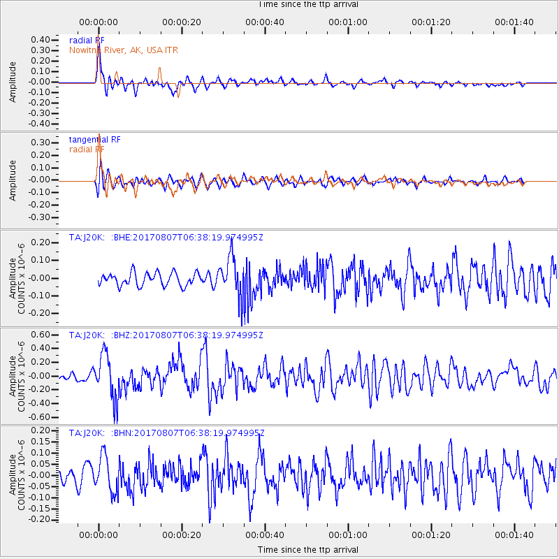
J20K Nowitna River, AK, USA - Earthquake Result Viewer
*The percent match for this event was below the threshold and hence no stack was calculated.
| Earthquake location: |
New Britain Region, P.N.G. |
| Earthquake latitude/longitude: |
-5.4/151.6 |
| Earthquake time(UTC): |
2017/08/07 (219) 06:26:44 GMT |
| Earthquake Depth: |
35 km |
| Earthquake Magnitude: |
5.8 Mww |
| Earthquake Catalog/Contributor: |
NEIC PDE/us |
|
| Network: |
TA USArray Transportable Network (new EarthScope stations) |
| Station: |
J20K Nowitna River, AK, USA |
| Lat/Lon: |
64.18 N/154.15 W |
| Elevation: |
314 m |
|
| Distance: |
80.2 deg |
| Az: |
21.158 deg |
| Baz: |
235.135 deg |
| Ray Param: |
$rayparam |
*The percent match for this event was below the threshold and hence was not used in the summary stack. |
|
| Radial Match: |
74.25723 % |
| Radial Bump: |
393 |
| Transverse Match: |
58.962425 % |
| Transverse Bump: |
400 |
| SOD ConfigId: |
13570011 |
| Insert Time: |
2019-04-28 13:11:28.276 +0000 |
| GWidth: |
2.5 |
| Max Bumps: |
400 |
| Tol: |
0.001 |
|
Signal To Noise
| Channel | StoN | STA | LTA |
| TA:J20K: :BHZ:20170807T06:38:19.974995Z | 6.7235255 | 3.2628748E-7 | 4.8529223E-8 |
| TA:J20K: :BHN:20170807T06:38:19.974995Z | 2.1912606 | 8.2039065E-8 | 3.7439207E-8 |
| TA:J20K: :BHE:20170807T06:38:19.974995Z | 3.2136855 | 1.1568753E-7 | 3.5998397E-8 |
| Arrivals |
| Ps | |
| PpPs | |
| PsPs/PpSs | |


