You are here: Home > Network List > TA - USArray Transportable Network (new EarthScope stations) Stations List
> Station J26L Joseph Creek, AK, USA > Earthquake Result Viewer
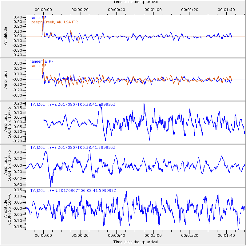
J26L Joseph Creek, AK, USA - Earthquake Result Viewer
*The percent match for this event was below the threshold and hence no stack was calculated.
| Earthquake location: |
New Britain Region, P.N.G. |
| Earthquake latitude/longitude: |
-5.4/151.6 |
| Earthquake time(UTC): |
2017/08/07 (219) 06:26:44 GMT |
| Earthquake Depth: |
35 km |
| Earthquake Magnitude: |
5.8 Mww |
| Earthquake Catalog/Contributor: |
NEIC PDE/us |
|
| Network: |
TA USArray Transportable Network (new EarthScope stations) |
| Station: |
J26L Joseph Creek, AK, USA |
| Lat/Lon: |
64.50 N/143.56 W |
| Elevation: |
1144 m |
|
| Distance: |
84.3 deg |
| Az: |
23.193 deg |
| Baz: |
244.941 deg |
| Ray Param: |
$rayparam |
*The percent match for this event was below the threshold and hence was not used in the summary stack. |
|
| Radial Match: |
74.201515 % |
| Radial Bump: |
400 |
| Transverse Match: |
68.339935 % |
| Transverse Bump: |
400 |
| SOD ConfigId: |
13570011 |
| Insert Time: |
2019-04-28 13:11:29.489 +0000 |
| GWidth: |
2.5 |
| Max Bumps: |
400 |
| Tol: |
0.001 |
|
Signal To Noise
| Channel | StoN | STA | LTA |
| TA:J26L: :BHZ:20170807T06:38:41.599995Z | 8.334837 | 3.448422E-7 | 4.13736E-8 |
| TA:J26L: :BHN:20170807T06:38:41.599995Z | 1.0724297 | 2.9178414E-8 | 2.7207765E-8 |
| TA:J26L: :BHE:20170807T06:38:41.599995Z | 4.0981474 | 1.2288952E-7 | 2.99866E-8 |
| Arrivals |
| Ps | |
| PpPs | |
| PsPs/PpSs | |


