You are here: Home > Network List > UW - Pacific Northwest Regional Seismic Network Stations List
> Station LEBA Lebam, WA, USA > Earthquake Result Viewer
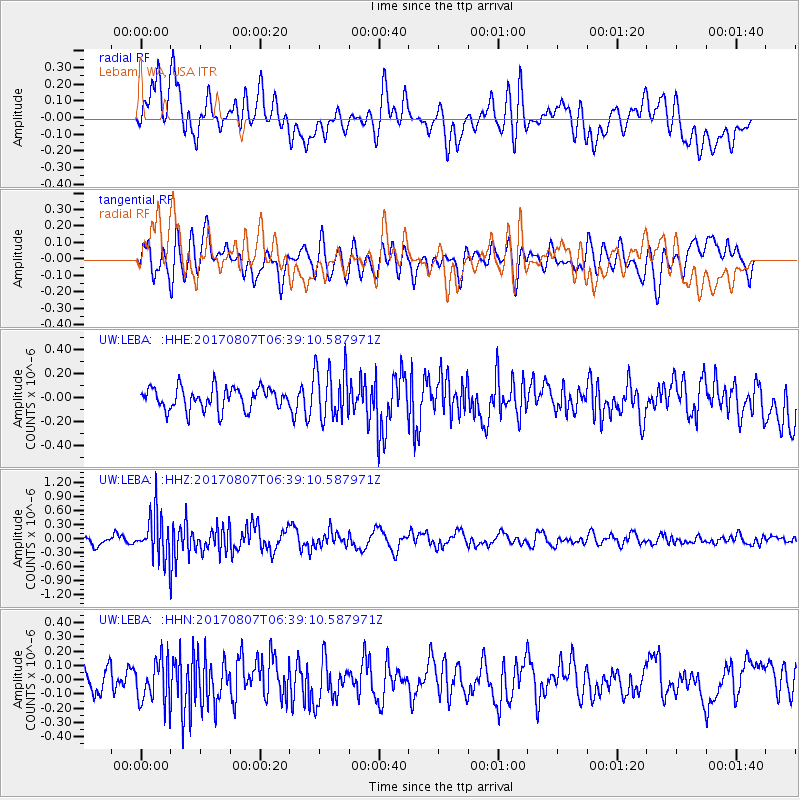
LEBA Lebam, WA, USA - Earthquake Result Viewer
*The percent match for this event was below the threshold and hence no stack was calculated.
| Earthquake location: |
New Britain Region, P.N.G. |
| Earthquake latitude/longitude: |
-5.4/151.6 |
| Earthquake time(UTC): |
2017/08/07 (219) 06:26:44 GMT |
| Earthquake Depth: |
35 km |
| Earthquake Magnitude: |
5.8 Mww |
| Earthquake Catalog/Contributor: |
NEIC PDE/us |
|
| Network: |
UW Pacific Northwest Regional Seismic Network |
| Station: |
LEBA Lebam, WA, USA |
| Lat/Lon: |
46.55 N/123.56 W |
| Elevation: |
73 m |
|
| Distance: |
90.4 deg |
| Az: |
43.43 deg |
| Baz: |
262.598 deg |
| Ray Param: |
$rayparam |
*The percent match for this event was below the threshold and hence was not used in the summary stack. |
|
| Radial Match: |
63.155945 % |
| Radial Bump: |
400 |
| Transverse Match: |
58.8114 % |
| Transverse Bump: |
400 |
| SOD ConfigId: |
13570011 |
| Insert Time: |
2019-04-28 13:13:02.109 +0000 |
| GWidth: |
2.5 |
| Max Bumps: |
400 |
| Tol: |
0.001 |
|
Signal To Noise
| Channel | StoN | STA | LTA |
| UW:LEBA: :HHZ:20170807T06:39:10.587971Z | 4.703762 | 4.854035E-7 | 1.0319474E-7 |
| UW:LEBA: :HHN:20170807T06:39:10.587971Z | 1.2620783 | 1.5142342E-7 | 1.1997942E-7 |
| UW:LEBA: :HHE:20170807T06:39:10.587971Z | 2.3913295 | 2.1594094E-7 | 9.0301626E-8 |
| Arrivals |
| Ps | |
| PpPs | |
| PsPs/PpSs | |


