You are here: Home > Network List > UW - Pacific Northwest Regional Seismic Network Stations List
> Station MRBL Marblemount, WA, USA > Earthquake Result Viewer
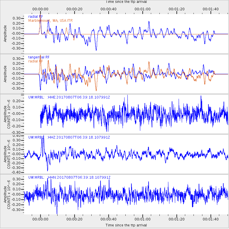
MRBL Marblemount, WA, USA - Earthquake Result Viewer
*The percent match for this event was below the threshold and hence no stack was calculated.
| Earthquake location: |
New Britain Region, P.N.G. |
| Earthquake latitude/longitude: |
-5.4/151.6 |
| Earthquake time(UTC): |
2017/08/07 (219) 06:26:44 GMT |
| Earthquake Depth: |
35 km |
| Earthquake Magnitude: |
5.8 Mww |
| Earthquake Catalog/Contributor: |
NEIC PDE/us |
|
| Network: |
UW Pacific Northwest Regional Seismic Network |
| Station: |
MRBL Marblemount, WA, USA |
| Lat/Lon: |
48.52 N/121.48 W |
| Elevation: |
75 m |
|
| Distance: |
92.0 deg |
| Az: |
41.632 deg |
| Baz: |
264.164 deg |
| Ray Param: |
$rayparam |
*The percent match for this event was below the threshold and hence was not used in the summary stack. |
|
| Radial Match: |
61.37895 % |
| Radial Bump: |
400 |
| Transverse Match: |
60.530117 % |
| Transverse Bump: |
400 |
| SOD ConfigId: |
13570011 |
| Insert Time: |
2019-04-28 13:13:04.304 +0000 |
| GWidth: |
2.5 |
| Max Bumps: |
400 |
| Tol: |
0.001 |
|
Signal To Noise
| Channel | StoN | STA | LTA |
| UW:MRBL: :HHZ:20170807T06:39:18.107991Z | 2.7818286 | 1.7619804E-7 | 6.333892E-8 |
| UW:MRBL: :HHN:20170807T06:39:18.107991Z | 1.5045921 | 1.0913266E-7 | 7.253305E-8 |
| UW:MRBL: :HHE:20170807T06:39:18.107991Z | 0.9774819 | 7.075954E-8 | 7.238962E-8 |
| Arrivals |
| Ps | |
| PpPs | |
| PsPs/PpSs | |


