You are here: Home > Network List > UW - Pacific Northwest Regional Seismic Network Stations List
> Station UMAT Pilot Rock, OR, USA > Earthquake Result Viewer
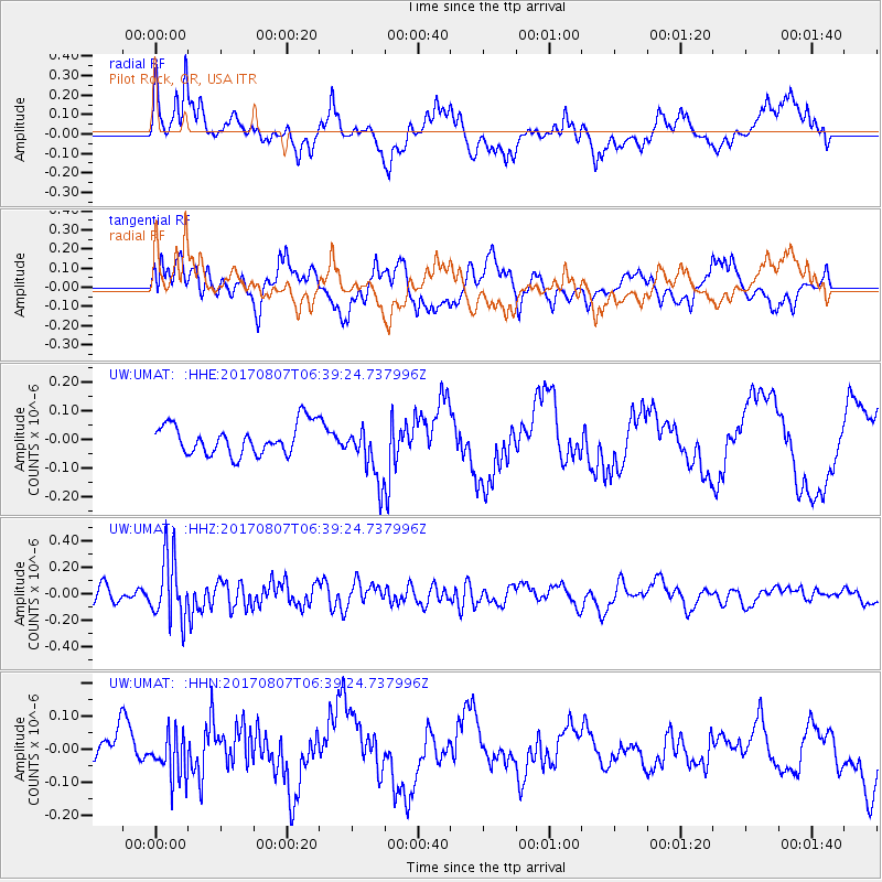
UMAT Pilot Rock, OR, USA - Earthquake Result Viewer
*The percent match for this event was below the threshold and hence no stack was calculated.
| Earthquake location: |
New Britain Region, P.N.G. |
| Earthquake latitude/longitude: |
-5.4/151.6 |
| Earthquake time(UTC): |
2017/08/07 (219) 06:26:44 GMT |
| Earthquake Depth: |
35 km |
| Earthquake Magnitude: |
5.8 Mww |
| Earthquake Catalog/Contributor: |
NEIC PDE/us |
|
| Network: |
UW Pacific Northwest Regional Seismic Network |
| Station: |
UMAT Pilot Rock, OR, USA |
| Lat/Lon: |
45.29 N/118.96 W |
| Elevation: |
1318 m |
|
| Distance: |
93.4 deg |
| Az: |
45.002 deg |
| Baz: |
265.844 deg |
| Ray Param: |
$rayparam |
*The percent match for this event was below the threshold and hence was not used in the summary stack. |
|
| Radial Match: |
45.431267 % |
| Radial Bump: |
394 |
| Transverse Match: |
61.31897 % |
| Transverse Bump: |
400 |
| SOD ConfigId: |
13570011 |
| Insert Time: |
2019-04-28 13:13:09.206 +0000 |
| GWidth: |
2.5 |
| Max Bumps: |
400 |
| Tol: |
0.001 |
|
Signal To Noise
| Channel | StoN | STA | LTA |
| UW:UMAT: :HHZ:20170807T06:39:24.737996Z | 3.5040362 | 2.4059116E-7 | 6.866115E-8 |
| UW:UMAT: :HHN:20170807T06:39:24.737996Z | 1.7128822 | 6.89974E-8 | 4.0281463E-8 |
| UW:UMAT: :HHE:20170807T06:39:24.737996Z | 1.8725297 | 9.840646E-8 | 5.2552682E-8 |
| Arrivals |
| Ps | |
| PpPs | |
| PsPs/PpSs | |


