You are here: Home > Network List > TA - USArray Transportable Network (new EarthScope stations) Stations List
> Station H19A Powell, WY, USA > Earthquake Result Viewer
H19A Powell, WY, USA - Earthquake Result Viewer

| Earthquake location: |
Near S. Coast Of Honshu, Japan |
| Earthquake latitude/longitude: |
33.2/137.9 |
| Earthquake time(UTC): |
2009/08/09 (221) 10:55:55 GMT |
| Earthquake Depth: |
297 km |
| Earthquake Magnitude: |
6.5 MB, 7.1 MW, 7.1 MW |
| Earthquake Catalog/Contributor: |
WHDF/NEIC |
|
| Network: |
TA USArray Transportable Network (new EarthScope stations) |
| Station: |
H19A Powell, WY, USA |
| Lat/Lon: |
44.67 N/108.99 W |
| Elevation: |
1479 m |
|
| Distance: |
81.5 deg |
| Az: |
41.579 deg |
| Baz: |
308.728 deg |
| Ray Param: |
0.046733595 |
| Estimated Moho Depth: |
54.25 km |
| Estimated Crust Vp/Vs: |
2.07 |
| Assumed Crust Vp: |
6.242 km/s |
| Estimated Crust Vs: |
3.012 km/s |
| Estimated Crust Poisson's Ratio: |
0.35 |
|
| Radial Match: |
86.27376 % |
| Radial Bump: |
400 |
| Transverse Match: |
86.27538 % |
| Transverse Bump: |
400 |
| SOD ConfigId: |
2622 |
| Insert Time: |
2010-03-06 02:36:33.676 +0000 |
| GWidth: |
2.5 |
| Max Bumps: |
400 |
| Tol: |
0.001 |
|
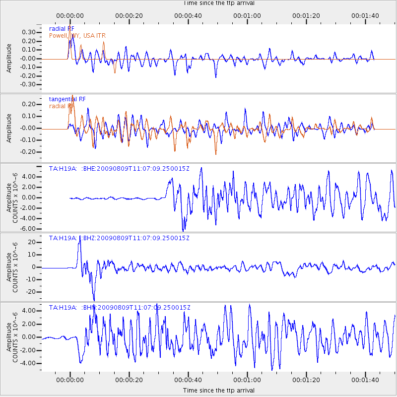
Signal To Noise
| Channel | StoN | STA | LTA |
| TA:H19A: :BHZ:20090809T11:07:09.250015Z | 82.957184 | 9.056153E-6 | 1.091666E-7 |
| TA:H19A: :BHN:20090809T11:07:09.250015Z | 11.423525 | 1.8362247E-6 | 1.6074063E-7 |
| TA:H19A: :BHE:20090809T11:07:09.250015Z | 16.436512 | 1.8498112E-6 | 1.1254281E-7 |
| Arrivals |
| Ps | 9.5 SECOND |
| PpPs | 26 SECOND |
| PsPs/PpSs | 36 SECOND |


