You are here: Home > Network List > IU - Global Seismograph Network (GSN - IRIS/USGS) Stations List
> Station XMAS Kiritimati Island, Republic of Kiribati > Earthquake Result Viewer
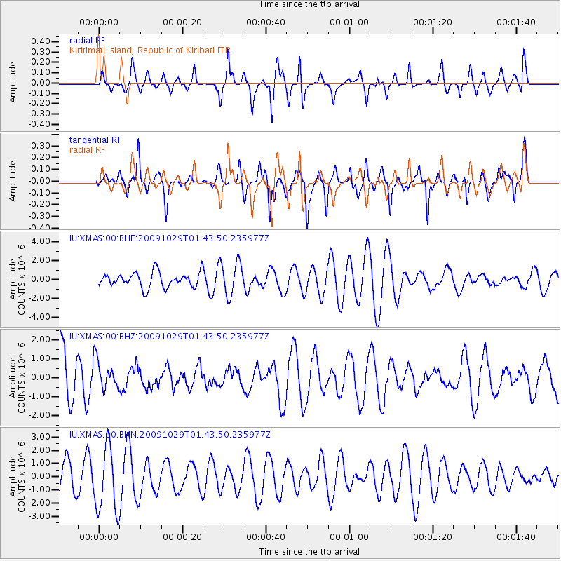
XMAS Kiritimati Island, Republic of Kiribati - Earthquake Result Viewer
*The percent match for this event was below the threshold and hence no stack was calculated.
| Earthquake location: |
Irian Jaya, Indonesia |
| Earthquake latitude/longitude: |
-5.3/140.4 |
| Earthquake time(UTC): |
2009/10/29 (302) 01:34:00 GMT |
| Earthquake Depth: |
29 km |
| Earthquake Magnitude: |
5.5 MB, 4.7 MS |
| Earthquake Catalog/Contributor: |
WHDF/NEIC |
|
| Network: |
IU Global Seismograph Network (GSN - IRIS/USGS) |
| Station: |
XMAS Kiritimati Island, Republic of Kiribati |
| Lat/Lon: |
2.04 N/157.45 W |
| Elevation: |
20 m |
|
| Distance: |
62.5 deg |
| Az: |
84.971 deg |
| Baz: |
263.042 deg |
| Ray Param: |
$rayparam |
*The percent match for this event was below the threshold and hence was not used in the summary stack. |
|
| Radial Match: |
46.810127 % |
| Radial Bump: |
356 |
| Transverse Match: |
56.3967 % |
| Transverse Bump: |
351 |
| SOD ConfigId: |
1 |
| Insert Time: |
2010-02-19 00:58:31.530 +0000 |
| GWidth: |
2.5 |
| Max Bumps: |
400 |
| Tol: |
0.001 |
|
Signal To Noise
| Channel | StoN | STA | LTA |
| IU:XMAS:00:BHZ:20091029T01:43:50.235977Z | 0.5839572 | 7.1348813E-7 | 1.2218159E-6 |
| IU:XMAS:00:BHN:20091029T01:43:50.235977Z | 2.8870368 | 2.536362E-6 | 8.785347E-7 |
| IU:XMAS:00:BHE:20091029T01:43:50.235977Z | 2.2720208 | 1.7570239E-6 | 7.733309E-7 |
| Arrivals |
| Ps | |
| PpPs | |
| PsPs/PpSs | |


