You are here: Home > Network List > TA - USArray Transportable Network (new EarthScope stations) Stations List
> Station H19A Powell, WY, USA > Earthquake Result Viewer
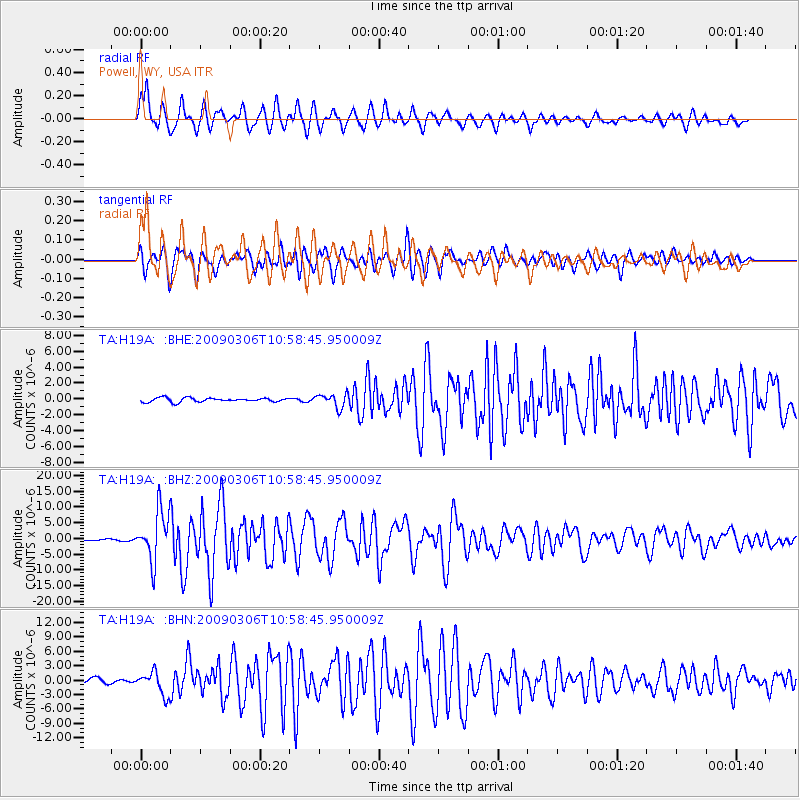
H19A Powell, WY, USA - Earthquake Result Viewer
*The percent match for this event was below the threshold and hence no stack was calculated.
| Earthquake location: |
North Of Svalbard |
| Earthquake latitude/longitude: |
80.3/-1.9 |
| Earthquake time(UTC): |
2009/03/06 (065) 10:50:29 GMT |
| Earthquake Depth: |
9.0 km |
| Earthquake Magnitude: |
6.6 MB, 6.5 MS, 6.5 MW, 6.4 MW |
| Earthquake Catalog/Contributor: |
WHDF/NEIC |
|
| Network: |
TA USArray Transportable Network (new EarthScope stations) |
| Station: |
H19A Powell, WY, USA |
| Lat/Lon: |
44.67 N/108.99 W |
| Elevation: |
1479 m |
|
| Distance: |
49.1 deg |
| Az: |
295.532 deg |
| Baz: |
12.354 deg |
| Ray Param: |
$rayparam |
*The percent match for this event was below the threshold and hence was not used in the summary stack. |
|
| Radial Match: |
74.364555 % |
| Radial Bump: |
400 |
| Transverse Match: |
76.85347 % |
| Transverse Bump: |
400 |
| SOD ConfigId: |
2658 |
| Insert Time: |
2010-03-06 02:37:53.681 +0000 |
| GWidth: |
2.5 |
| Max Bumps: |
400 |
| Tol: |
0.001 |
|
Signal To Noise
| Channel | StoN | STA | LTA |
| TA:H19A: :BHZ:20090306T10:58:45.950009Z | 29.494211 | 7.882257E-6 | 2.6724757E-7 |
| TA:H19A: :BHN:20090306T10:58:45.950009Z | 5.4117727 | 2.3998568E-6 | 4.4345114E-7 |
| TA:H19A: :BHE:20090306T10:58:45.950009Z | 3.4097946 | 8.730391E-7 | 2.5603862E-7 |
| Arrivals |
| Ps | |
| PpPs | |
| PsPs/PpSs | |


