You are here: Home > Network List > UW - Pacific Northwest Regional Seismic Network Stations List
> Station MRBL Marblemount, WA, USA > Earthquake Result Viewer
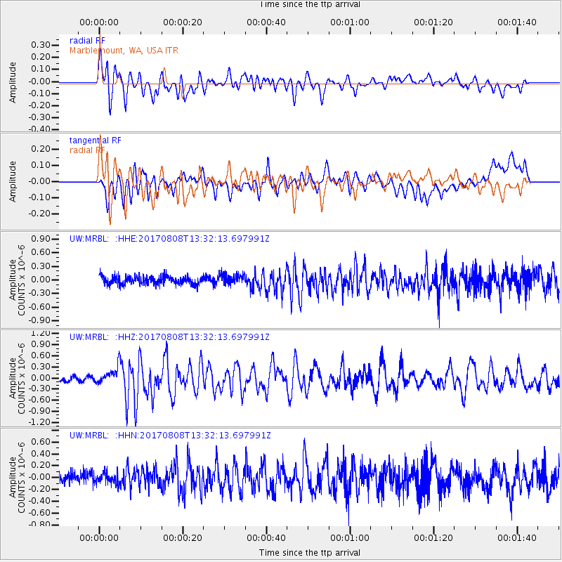
MRBL Marblemount, WA, USA - Earthquake Result Viewer
*The percent match for this event was below the threshold and hence no stack was calculated.
| Earthquake location: |
Gansu, China |
| Earthquake latitude/longitude: |
33.2/103.8 |
| Earthquake time(UTC): |
2017/08/08 (220) 13:19:49 GMT |
| Earthquake Depth: |
10 km |
| Earthquake Magnitude: |
6.5 Mww |
| Earthquake Catalog/Contributor: |
NEIC PDE/us |
|
| Network: |
UW Pacific Northwest Regional Seismic Network |
| Station: |
MRBL Marblemount, WA, USA |
| Lat/Lon: |
48.52 N/121.48 W |
| Elevation: |
75 m |
|
| Distance: |
89.1 deg |
| Az: |
28.221 deg |
| Baz: |
323.401 deg |
| Ray Param: |
$rayparam |
*The percent match for this event was below the threshold and hence was not used in the summary stack. |
|
| Radial Match: |
68.60141 % |
| Radial Bump: |
400 |
| Transverse Match: |
59.624977 % |
| Transverse Bump: |
400 |
| SOD ConfigId: |
13570011 |
| Insert Time: |
2019-04-28 13:29:12.585 +0000 |
| GWidth: |
2.5 |
| Max Bumps: |
400 |
| Tol: |
0.001 |
|
Signal To Noise
| Channel | StoN | STA | LTA |
| UW:MRBL: :HHZ:20170808T13:32:13.697991Z | 3.5538852 | 2.314411E-7 | 6.512341E-8 |
| UW:MRBL: :HHN:20170808T13:32:13.697991Z | 1.1092907 | 9.1092275E-8 | 8.211759E-8 |
| UW:MRBL: :HHE:20170808T13:32:13.697991Z | 1.2560953 | 1.1372661E-7 | 9.053979E-8 |
| Arrivals |
| Ps | |
| PpPs | |
| PsPs/PpSs | |


