You are here: Home > Network List > UW - Pacific Northwest Regional Seismic Network Stations List
> Station FISH Seaside, OR, USA > Earthquake Result Viewer
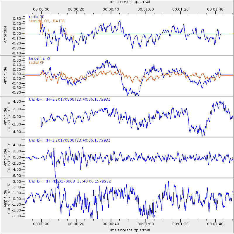
FISH Seaside, OR, USA - Earthquake Result Viewer
*The percent match for this event was below the threshold and hence no stack was calculated.
| Earthquake location: |
Northern Xinjiang, China |
| Earthquake latitude/longitude: |
44.3/82.8 |
| Earthquake time(UTC): |
2017/08/08 (220) 23:27:53 GMT |
| Earthquake Depth: |
20 km |
| Earthquake Magnitude: |
6.3 Mww |
| Earthquake Catalog/Contributor: |
NEIC PDE/us |
|
| Network: |
UW Pacific Northwest Regional Seismic Network |
| Station: |
FISH Seaside, OR, USA |
| Lat/Lon: |
45.93 N/123.56 W |
| Elevation: |
325 m |
|
| Distance: |
87.2 deg |
| Az: |
18.099 deg |
| Baz: |
341.363 deg |
| Ray Param: |
$rayparam |
*The percent match for this event was below the threshold and hence was not used in the summary stack. |
|
| Radial Match: |
52.131977 % |
| Radial Bump: |
400 |
| Transverse Match: |
77.52364 % |
| Transverse Bump: |
400 |
| SOD ConfigId: |
13570011 |
| Insert Time: |
2019-04-28 13:41:35.671 +0000 |
| GWidth: |
2.5 |
| Max Bumps: |
400 |
| Tol: |
0.001 |
|
Signal To Noise
| Channel | StoN | STA | LTA |
| UW:FISH: :HHZ:20170808T23:40:06.157993Z | 2.2514598 | 1.017905E-6 | 4.521089E-7 |
| UW:FISH: :HHN:20170808T23:40:06.157993Z | 1.4927909 | 8.2351005E-7 | 5.51658E-7 |
| UW:FISH: :HHE:20170808T23:40:06.157993Z | 2.5414126 | 1.93341E-6 | 7.6076196E-7 |
| Arrivals |
| Ps | |
| PpPs | |
| PsPs/PpSs | |


