You are here: Home > Network List > TA - USArray Transportable Network (new EarthScope stations) Stations List
> Station A18A Metzger Ranch, Havre, MT, USA > Earthquake Result Viewer
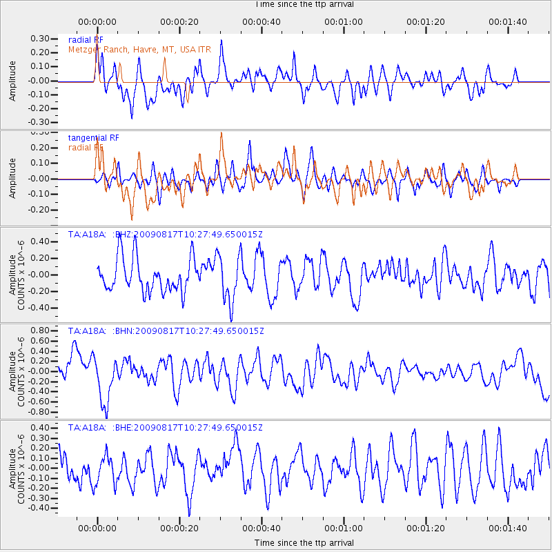
A18A Metzger Ranch, Havre, MT, USA - Earthquake Result Viewer
*The percent match for this event was below the threshold and hence no stack was calculated.
| Earthquake location: |
Southwestern Ryukyu Isl., Japan |
| Earthquake latitude/longitude: |
23.4/123.7 |
| Earthquake time(UTC): |
2009/08/17 (229) 10:15:05 GMT |
| Earthquake Depth: |
10 km |
| Earthquake Magnitude: |
5.7 MB |
| Earthquake Catalog/Contributor: |
WHDF/NEIC |
|
| Network: |
TA USArray Transportable Network (new EarthScope stations) |
| Station: |
A18A Metzger Ranch, Havre, MT, USA |
| Lat/Lon: |
48.92 N/109.85 W |
| Elevation: |
804 m |
|
| Distance: |
93.6 deg |
| Az: |
32.119 deg |
| Baz: |
312.232 deg |
| Ray Param: |
$rayparam |
*The percent match for this event was below the threshold and hence was not used in the summary stack. |
|
| Radial Match: |
55.315556 % |
| Radial Bump: |
400 |
| Transverse Match: |
59.29107 % |
| Transverse Bump: |
400 |
| SOD ConfigId: |
2622 |
| Insert Time: |
2010-03-06 02:43:36.657 +0000 |
| GWidth: |
2.5 |
| Max Bumps: |
400 |
| Tol: |
0.001 |
|
Signal To Noise
| Channel | StoN | STA | LTA |
| TA:A18A: :BHN:20090817T10:27:49.650015Z | 1.6993194 | 4.6203252E-7 | 2.7189267E-7 |
| TA:A18A: :BHE:20090817T10:27:49.650015Z | 0.79201514 | 1.4695716E-7 | 1.8554844E-7 |
| TA:A18A: :BHZ:20090817T10:27:49.650015Z | 1.4280535 | 2.8716934E-7 | 2.0109145E-7 |
| Arrivals |
| Ps | |
| PpPs | |
| PsPs/PpSs | |


