You are here: Home > Network List > AV - Alaska Volcano Observatory Stations List
> Station AMKA Regional Station, Amchitka Island, Alaska > Earthquake Result Viewer
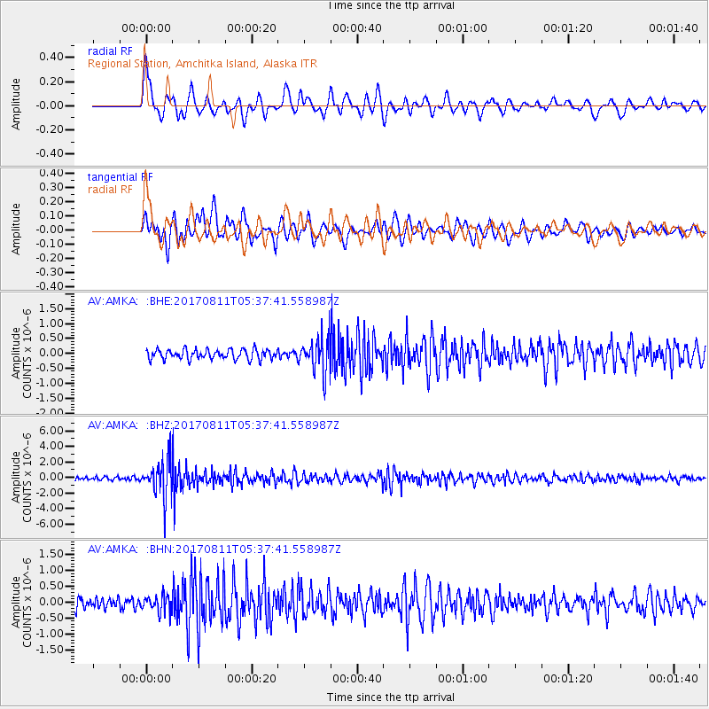
AMKA Regional Station, Amchitka Island, Alaska - Earthquake Result Viewer
*The percent match for this event was below the threshold and hence no stack was calculated.
| Earthquake location: |
Luzon, Philippines |
| Earthquake latitude/longitude: |
14.0/120.7 |
| Earthquake time(UTC): |
2017/08/11 (223) 05:28:25 GMT |
| Earthquake Depth: |
168 km |
| Earthquake Magnitude: |
6.2 Mww |
| Earthquake Catalog/Contributor: |
NEIC PDE/us |
|
| Network: |
AV Alaska Volcano Observatory |
| Station: |
AMKA Regional Station, Amchitka Island, Alaska |
| Lat/Lon: |
51.38 N/179.30 E |
| Elevation: |
116 m |
|
| Distance: |
59.7 deg |
| Az: |
38.279 deg |
| Baz: |
253.626 deg |
| Ray Param: |
$rayparam |
*The percent match for this event was below the threshold and hence was not used in the summary stack. |
|
| Radial Match: |
79.5059 % |
| Radial Bump: |
400 |
| Transverse Match: |
78.35945 % |
| Transverse Bump: |
400 |
| SOD ConfigId: |
13570011 |
| Insert Time: |
2019-04-28 13:52:52.482 +0000 |
| GWidth: |
2.5 |
| Max Bumps: |
400 |
| Tol: |
0.001 |
|
Signal To Noise
| Channel | StoN | STA | LTA |
| AV:AMKA: :BHZ:20170811T05:37:41.558987Z | 14.140251 | 2.428762E-6 | 1.717623E-7 |
| AV:AMKA: :BHN:20170811T05:37:41.558987Z | 1.5103883 | 2.588273E-7 | 1.7136475E-7 |
| AV:AMKA: :BHE:20170811T05:37:41.558987Z | 3.8045955 | 6.1619295E-7 | 1.6196017E-7 |
| Arrivals |
| Ps | |
| PpPs | |
| PsPs/PpSs | |


