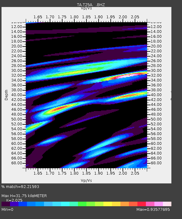
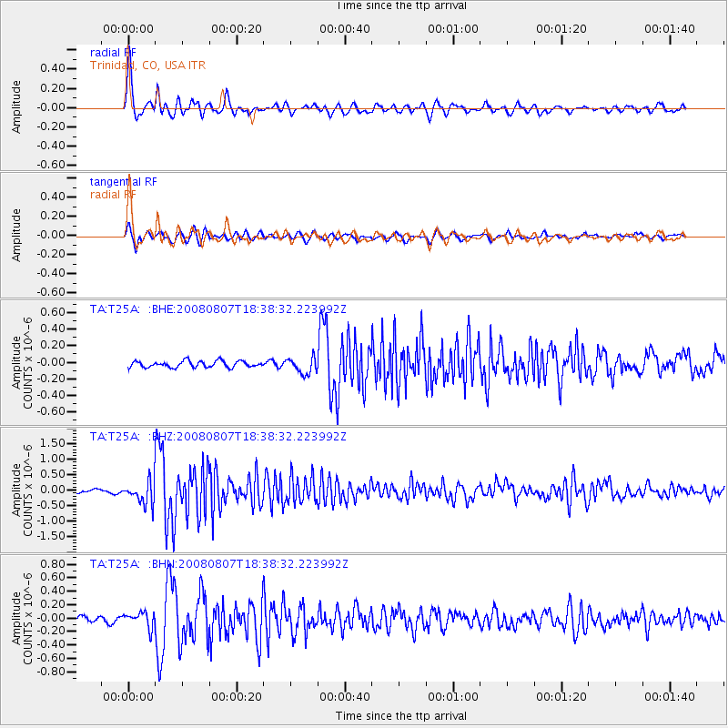
T25A Trinidad, CO, USA - Earthquake Result Viewer

Earthquake location: Andreanof Islands, Aleutian Is.
Earthquake latitude/longitude: 52.2/-175.7
Earthquake time(UTC): 2008/08/07 (220) 18:30:03 GMT
Earthquake Depth: 12 km
Earthquake Magnitude: 5.6 MB, 5.5 MS, 5.8 MW, 5.8 MW
Earthquake Catalog/Contributor: WHDF/NEIC
Network: TA USArray Transportable Network (new EarthScope stations)
Station: T25A Trinidad, CO, USA
Lat/Lon: 37.14 N/104.41 W
Elevation: 2017 m
Distance: 50.8 deg
Az: 77.514 deg
Baz: 311.224 deg
Ray Param: 0.067804575
Estimated Moho Depth: 31.75 km
Estimated Crust Vp/Vs: 2.03
Assumed Crust Vp: 6.316 km/s
Estimated Crust Vs: 3.119 km/s
Estimated Crust Poisson's Ratio: 0.34
Radial Match: 92.21593 %
Radial Bump: 400
Transverse Match: 85.380875 %
Transverse Bump: 400
SOD ConfigId: 2504
Insert Time: 2010-03-06 02:45:06.482 +0000
GWidth: 2.5
Max Bumps: 400
Tol: 0.001

Signal To Noise

ChannelStoNSTALTA
TA:T25A: :BHZ:20080807T18:38:32.223992Z8.0275413.6202857E-74.5098318E-8
TA:T25A: :BHN:20080807T18:38:32.223992Z2.37487651.1242029E-74.7337316E-8
TA:T25A: :BHE:20080807T18:38:32.223992Z2.5741269.7336844E-83.781355E-8
Arrivals
Ps5.4 SECOND
PpPs14 SECOND
PsPs/PpSs20 SECOND