You are here: Home > Network List > TA - USArray Transportable Network (new EarthScope stations) Stations List
> Station A21K Barrow, AK, USA > Earthquake Result Viewer
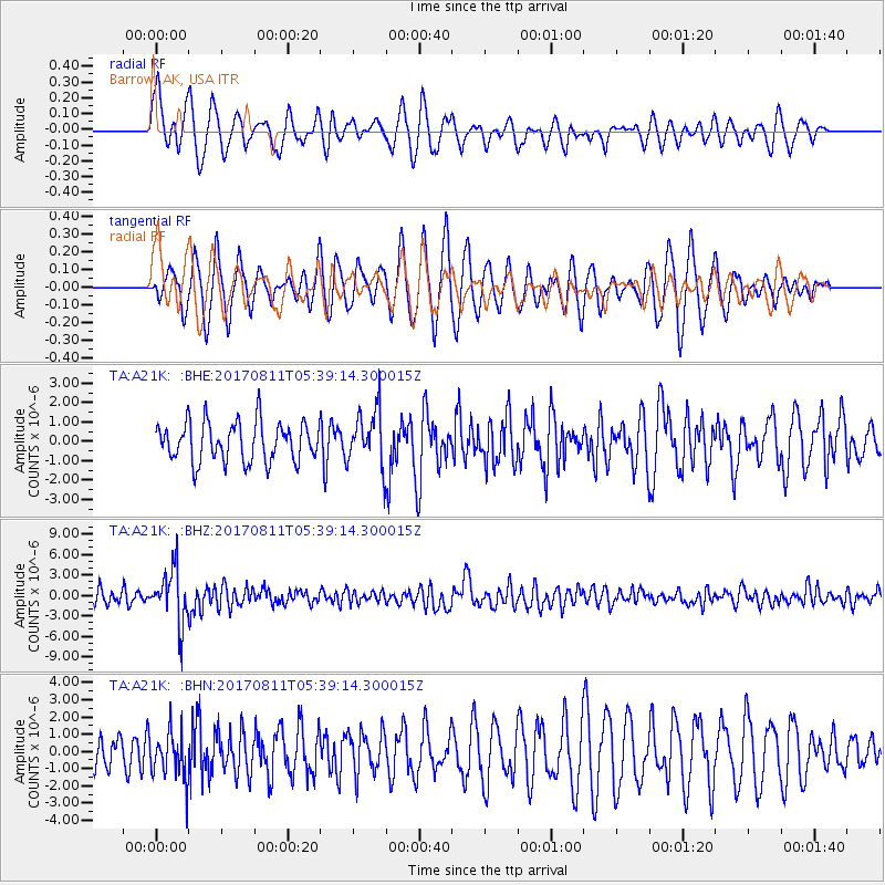
A21K Barrow, AK, USA - Earthquake Result Viewer
*The percent match for this event was below the threshold and hence no stack was calculated.
| Earthquake location: |
Luzon, Philippines |
| Earthquake latitude/longitude: |
14.0/120.7 |
| Earthquake time(UTC): |
2017/08/11 (223) 05:28:25 GMT |
| Earthquake Depth: |
168 km |
| Earthquake Magnitude: |
6.2 Mww |
| Earthquake Catalog/Contributor: |
NEIC PDE/us |
|
| Network: |
TA USArray Transportable Network (new EarthScope stations) |
| Station: |
A21K Barrow, AK, USA |
| Lat/Lon: |
71.32 N/156.62 W |
| Elevation: |
577 m |
|
| Distance: |
74.5 deg |
| Az: |
19.369 deg |
| Baz: |
267.639 deg |
| Ray Param: |
$rayparam |
*The percent match for this event was below the threshold and hence was not used in the summary stack. |
|
| Radial Match: |
67.78241 % |
| Radial Bump: |
400 |
| Transverse Match: |
62.092724 % |
| Transverse Bump: |
400 |
| SOD ConfigId: |
13570011 |
| Insert Time: |
2019-04-28 13:56:18.828 +0000 |
| GWidth: |
2.5 |
| Max Bumps: |
400 |
| Tol: |
0.001 |
|
Signal To Noise
| Channel | StoN | STA | LTA |
| TA:A21K: :BHZ:20170811T05:39:14.300015Z | 3.8679829 | 3.9562333E-6 | 1.0228156E-6 |
| TA:A21K: :BHN:20170811T05:39:14.300015Z | 1.1731441 | 1.3651704E-6 | 1.1636852E-6 |
| TA:A21K: :BHE:20170811T05:39:14.300015Z | 1.4783448 | 1.514789E-6 | 1.0246521E-6 |
| Arrivals |
| Ps | |
| PpPs | |
| PsPs/PpSs | |


