T25A Trinidad, CO, USA - Earthquake Result Viewer
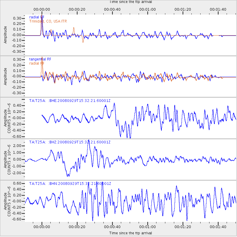
Earthquake location: Kermadec Islands, New Zealand
Earthquake latitude/longitude: -29.8/-177.7
Earthquake time(UTC): 2008/09/29 (273) 15:19:31 GMT
Earthquake Depth: 36 km
Earthquake Magnitude: 6.5 MB, 6.7 MS, 7.0 MW, 7.0 MW
Earthquake Catalog/Contributor: WHDF/NEIC
Network: TA USArray Transportable Network (new EarthScope stations)
Station: T25A Trinidad, CO, USA
Lat/Lon: 37.14 N/104.41 W
Elevation: 2017 m
Distance: 95.6 deg
Az: 50.257 deg
Baz: 236.795 deg
Ray Param: 0.040733967
Estimated Moho Depth: 19.5 km
Estimated Crust Vp/Vs: 1.85
Assumed Crust Vp: 6.316 km/s
Estimated Crust Vs: 3.418 km/s
Estimated Crust Poisson's Ratio: 0.29
Radial Match: 88.153885 %
Radial Bump: 400
Transverse Match: 75.674126 %
Transverse Bump: 400
SOD ConfigId: 2560
Insert Time: 2010-03-06 02:45:18.553 +0000
GWidth: 2.5
Max Bumps: 400
Tol: 0.001

Signal To Noise

ChannelStoNSTALTA
TA:T25A: :BHZ:20080929T15:32:21.60001Z2.8655963.2136938E-71.1214748E-7
TA:T25A: :BHN:20080929T15:32:21.60001Z1.29139271.0979823E-78.502312E-8
TA:T25A: :BHE:20080929T15:32:21.60001Z0.59920884.7661725E-87.95411E-8
Arrivals
Ps2.7 SECOND
PpPs8.6 SECOND
PsPs/PpSs11 SECOND